Quartiere "La Falchera" Torino

Il quartiere satellite disegnato dove le strade hanno i nomi di alberi
La Falchera (Farchera in piemontese) è un quartiere della Circoscrizione 6 di Torino, situato nell'estrema periferia nord della città. Per consuetudine locale, la zona viene suddivisa in tre borgate (Borgo Vecchio, Falchera Vecchia e Falchera Nuova), che da strada provinciale di Cuorgnè si sviluppano in direzione est; il versante ovest, dal canto suo, ha conosciuto una minore espansione urbanistica e architettonica (per lo più lungo strada della Barberina) e presenta ampi tratti di territorio a tutt'oggi non urbanizzati.
Informazioni a cura di:
Staff Landscapefor (2015-2026)
Coordinate geografiche:
45.129° 7.7078°
Indirizzo:
falcheraTag:
#quartiere, #xx-sec.
Media presenti
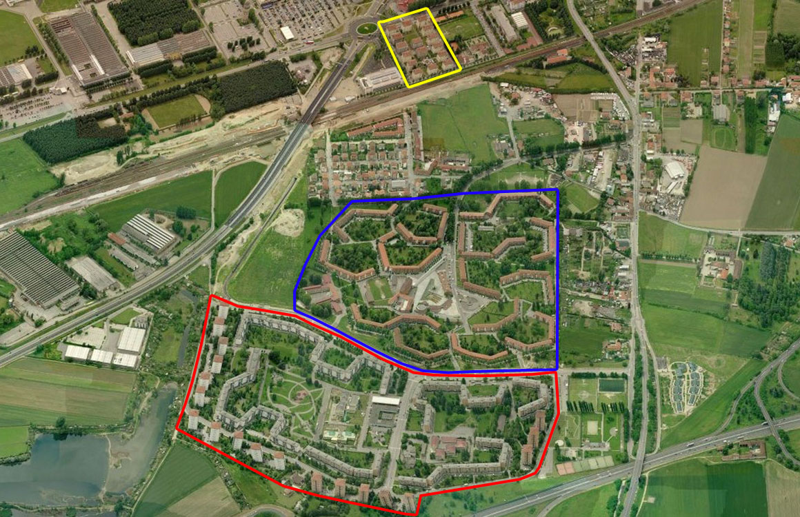
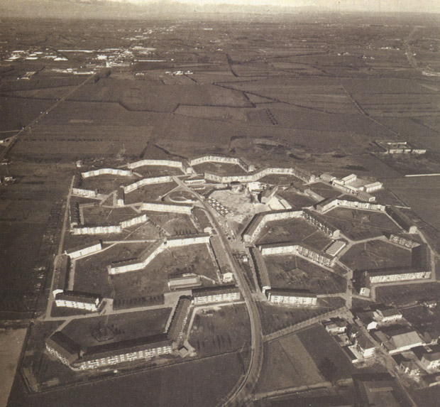
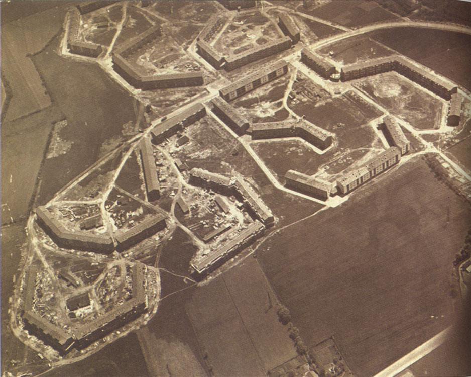
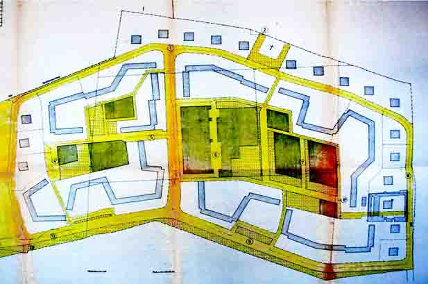
Foto aerea da nord: in alto il quartiere di edilizia aziendale Snia Viscosa (giallo), di fine ‘800, sotto Falchera vecchia (blu) e in primo piano Falchera nuova (rosso).
Contesto / Un quartiere esterno alla città
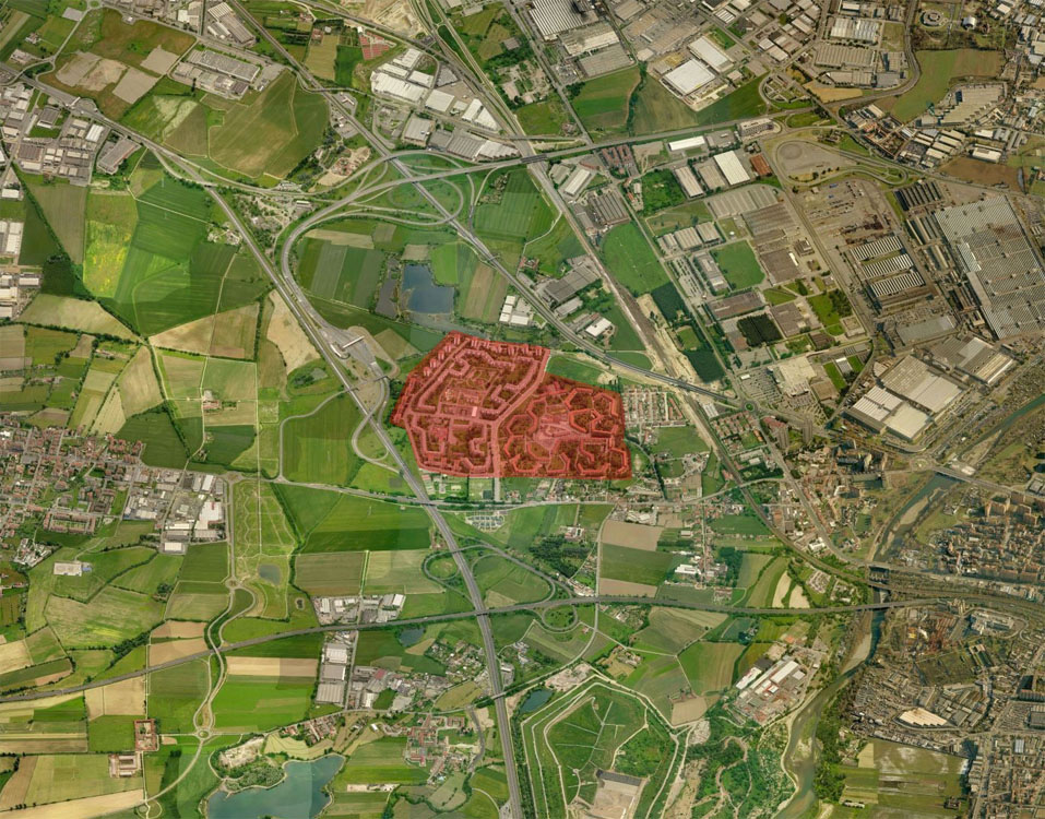
Il complesso residenziale Falchera è inserito in un contesto che è rimasto simile dall'epoca della sua costruzione, negli anni '50: ai bordi territorio agricolo e due infrastrutture molto poco permeabili: la ferrovia TAV e l'autostrada To-Mi. Per questo lo storico isolamento del quartiere, la mancata saldatura con la periferia della città non pianificata e l'obbligata autonomia dell'intero complesso residenziale per quanto riguarda i servizi.
Storia / Il piano ina casa
Il progetto nasce per far fronte all'emergenza abitativa del dopoguerra, in parte dovuta al forte flusso migratorio attratto dallo sviluppo industriale. Vengono varati alcuni programmi di edilizia popolare gestiti dall'Ina-Casa. Con Falchera si situano all'estremo nord della città 6.000 nuovi abitanti, in prossimità delle aree industriali Snia Viscosa e Fiat. In modo analogo alcuni anni dopo si sviluppa a sud della città Mirafiori che nel pieno sviluppo accoglierà 12.000 abitanti.
Storia / Il rapporto con l'urbanistica
Il complesso iniziale di Falchera, poi chiamata 'vecchia', è frutto di un disegno unitario che risponde ai modelli urbanistici delle unità di vicinato autosufficienti, inserita nel territorio come una sorta di new town anglosassone a se stante, circondata dalla campagna non urbanizzata e staccata dal piano regolatore.
Storia / Falchera 2
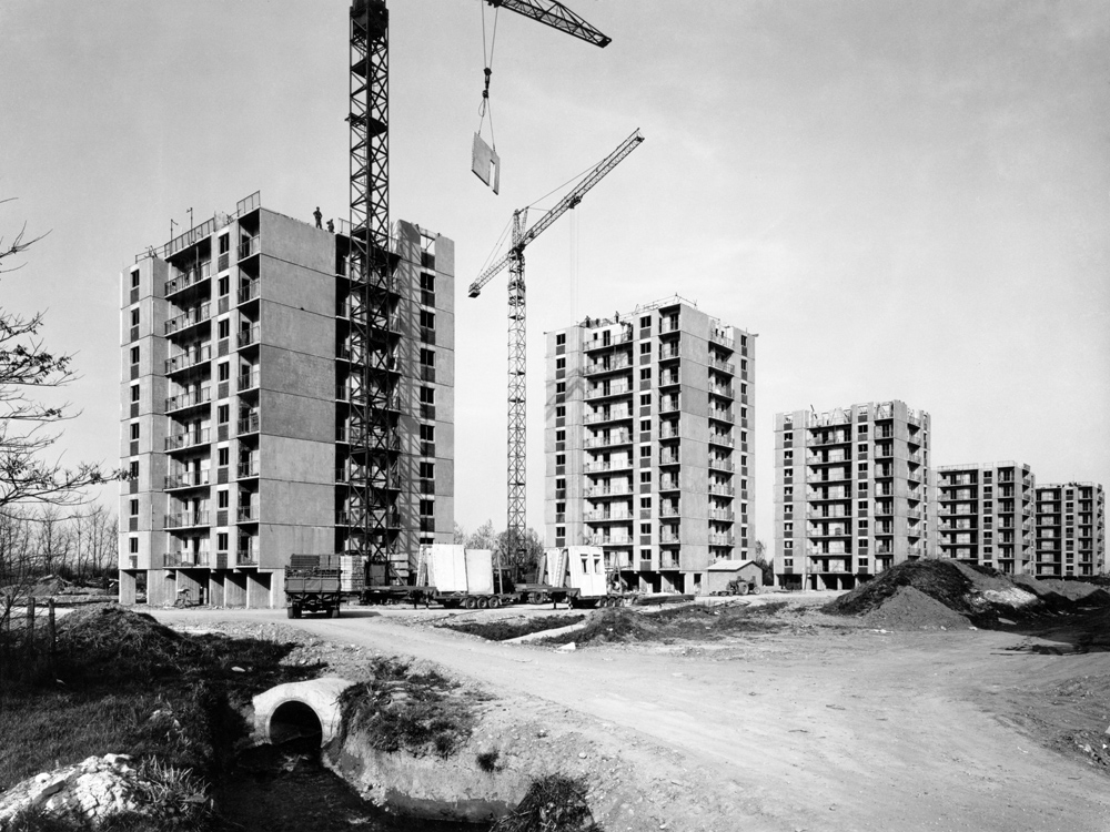
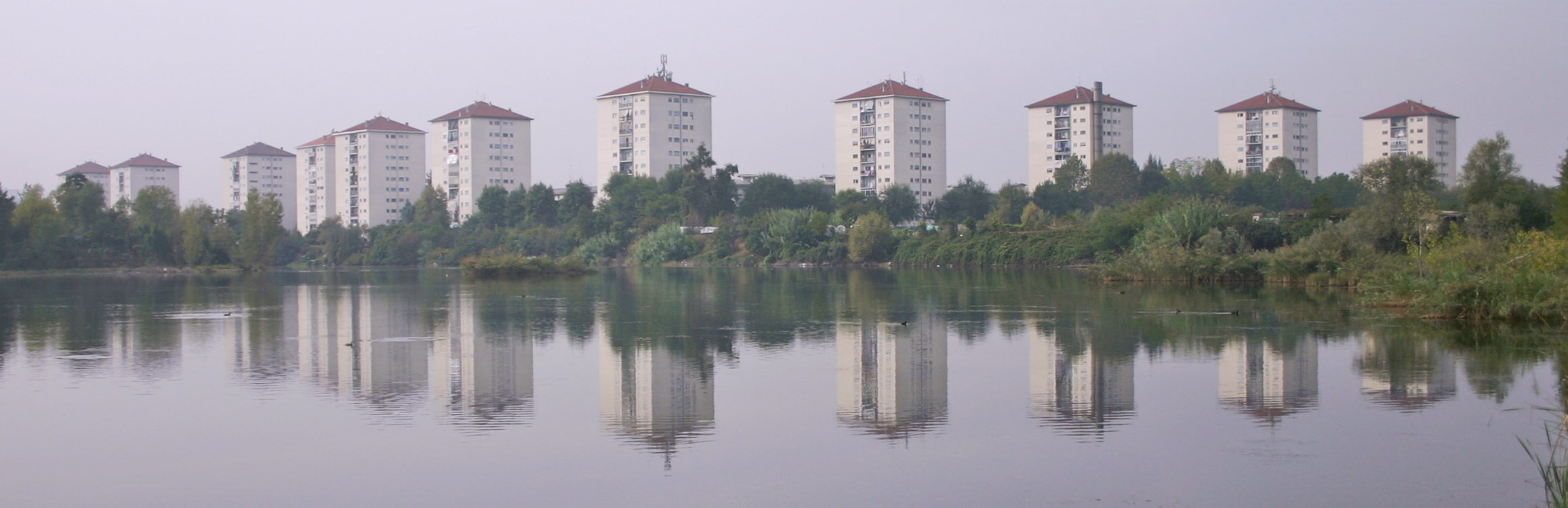
Nei primi anni '70 il quartiere è ampliato verso nord per rispondere alla crescente domanda di edilizia popolare. L'impianto urbanistico di quella che viene chiamata 'Falchera nuova' riprende l'impianto planimetrico del primo insediamento introducendo però due tipologie edilizie: case a schiera di quattro piani f.t. e case a torre di dieci piani f.t., che rendono molto più alta la densità edificata e quindi il peso della popolazione insediata, in termini di servizi e di trasporti.
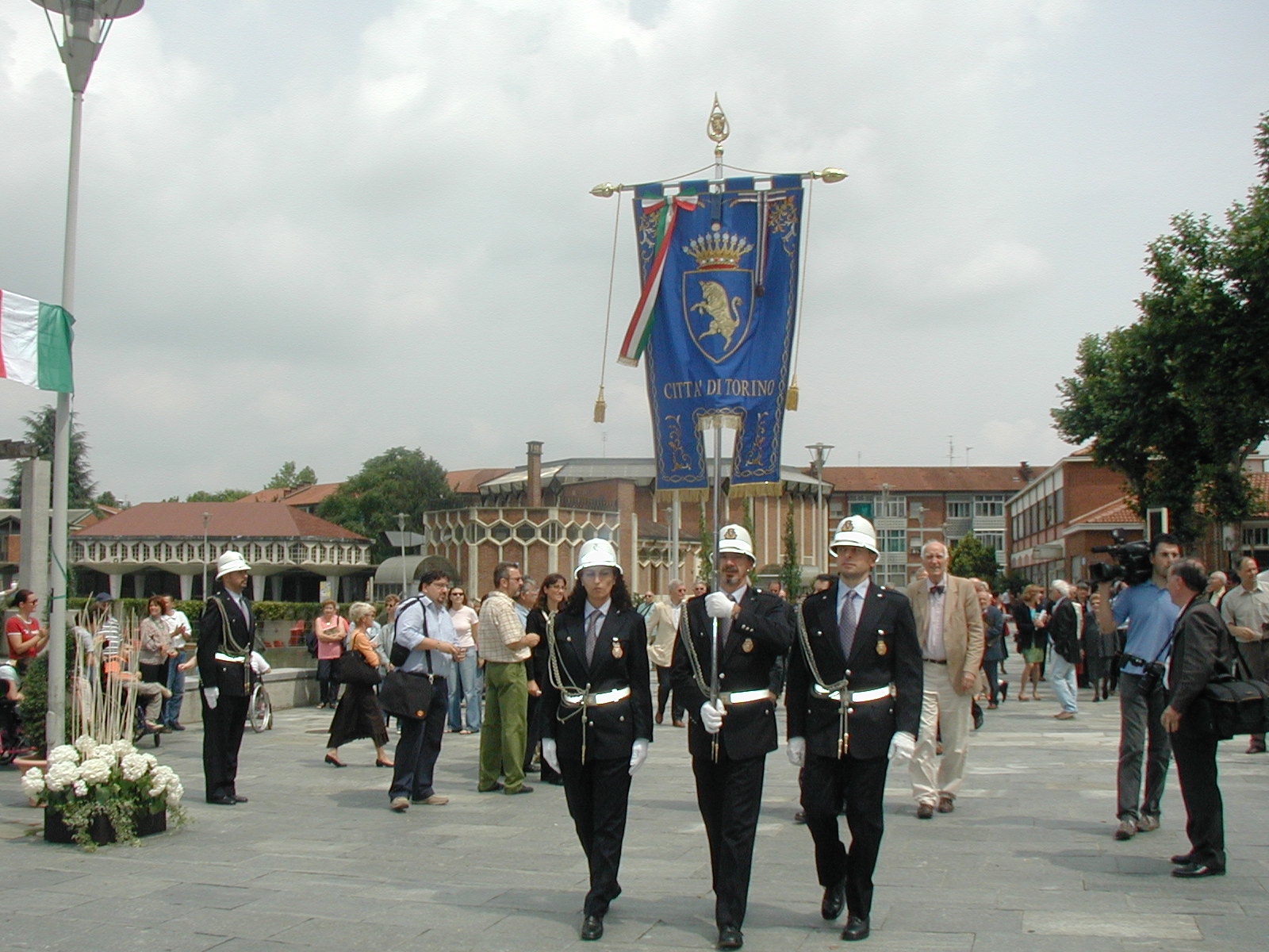
Storia / La piazza oggi
La piazza è articolata in quattro parti, ciascuna con identità, usi e caratteri architettonici diversi.
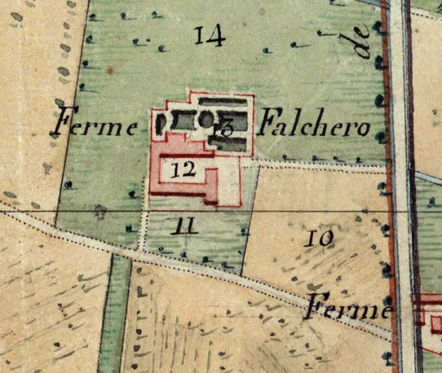
Storia / La campagna preesistente
La fascia irrigua intorno a Torino è terra fertile utilizzata da secoli, e organizzata dal ‘600 a tutto il ‘900 in grandi appezzamenti facenti capo a fattorie complesse, con grandi costruzioni intorno a corti aperte. Edifici e lottizzazioni costituiscono segni geometrici nel paesaggio con filari, canali ed edifici ben organizzati rispetto ai percorsi e agli spazi aperti limitrofi, sistemati a corte e a giardino. E' un modello che suggerisce al gruppo Astengo la tipologia di impianto che cara...
Storia / La realizzazione delle residenze
Il cantiere di Falchera vecchia visto da ovest, con i blocchi del primo lotto terminati e quelli del secondo in fase di ultimazione, 1955.
Storia / La piazza in costruzione
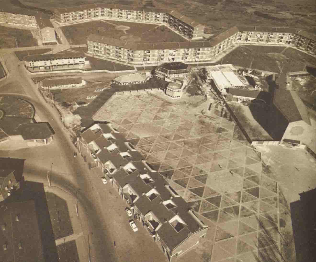
Il nucleo centrale del quartiere è impostato su una piazza triangolare e porticata di oltre 14.000 m2, intorno a cui sono concentrati i sevizi di quartiere (sulla destra la Chiesa inaugurata nel maggio del 1957). La piazza, realizzata nel suo complesso sin dalla prima fase, e intitolata ad Astengo dal 2007, (l'urbanista ideatore del progetto complessivo), è rimasta sempre sottoutilizzata, senza una fisionomia definita e caratterizzante.
Progetti / Il progetto complessivo
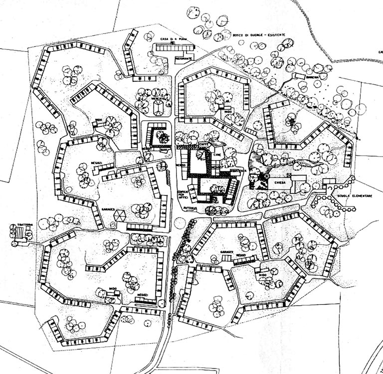
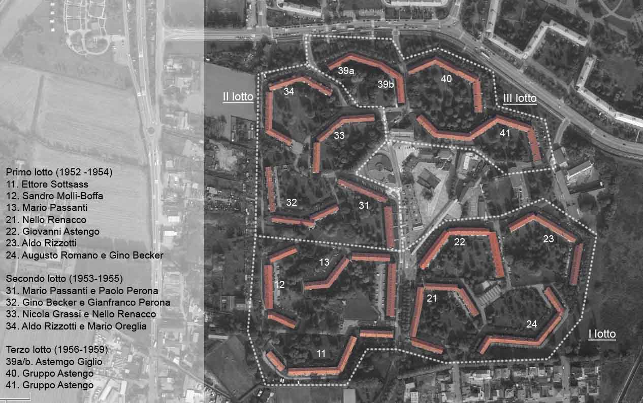
Nel 1950 la Gestione Ina casa affida il progetto urbanistico (e le regole per quelli edilizi) ad un gruppo di progettisti (S. Molli Boffa, M. Passanti, N. Renacco, A. Rizzotti) con G. Astengo come capogruppo. Secondo il piano si urbanizzano 30 ettari con residenze per 1.446 alloggi e 6.000 abitanti. Gli edifici, mediamente di lunghezza 60-70m, e 3 piani di altezza, sono poligoni ad angolo convesso prevalentemente affacciati a sud e formanti ampie zone interne a verde, (che occupa circa il 70%...
Progetti / I modelli insediativi
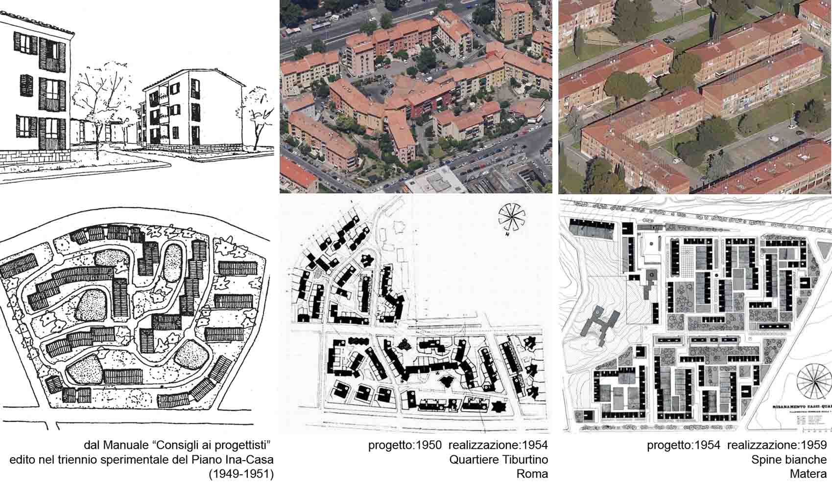
Falchera vecchia costituisce un modello perfettamente adeguato a quanto proposto da Ina-Casa nel volume 'Consigli ai progettisti', in cui richiamano i modi di aggregazione dell'unità di vicinato di matrice anglosassone o rurale. (vedi negli stessi anni il Tiburtino a Roma o Spine bianche a Matera). "L'idea di case a tre piani con ampi spazi verdi interclusi nacque, si può dire, sul posto, guardando il paesaggio e la campagna e considerando gli insediamenti rurali circostanti, le cascine quasi...
Progetti / I progetti edilizi
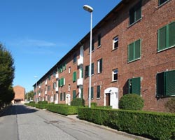
Il quartiere venne costruito a lotti successivi affidando la progettazione edilizia a nomi di spicco della cultura architettonica locale. Il capitolato del piano generale definiva i blocchi residenziali nel dettaglio: altezza massima pari a tre piani fuori terra, facciate in laterizio a vista, copertura a falde in coppi. Questo ha permesso una caratterizzazione morfologica molto forte e riconoscibile del complesso.
Progetti / Riqualificazione piazza Astengo
L'intervento di riqualificazione, definito con la partecipazione degli abitanti nell'ambito del concorso "Cento piazze per Torino", si realizza nel 2004. Il progetto degli arch Maffioletti e Sordina ha previsto una piazza pedonale, dedicata all'incontro e alla socialità dei residenti, articolata in quattro parti ciascuna con identità, usi e caratteri architettonici diversi. Recentemente la piazza è stata nuovamente oggetto di riqualificazioni dovute al degrado e al vandalismo.
Progetti / Riqualificazione dei laghetti
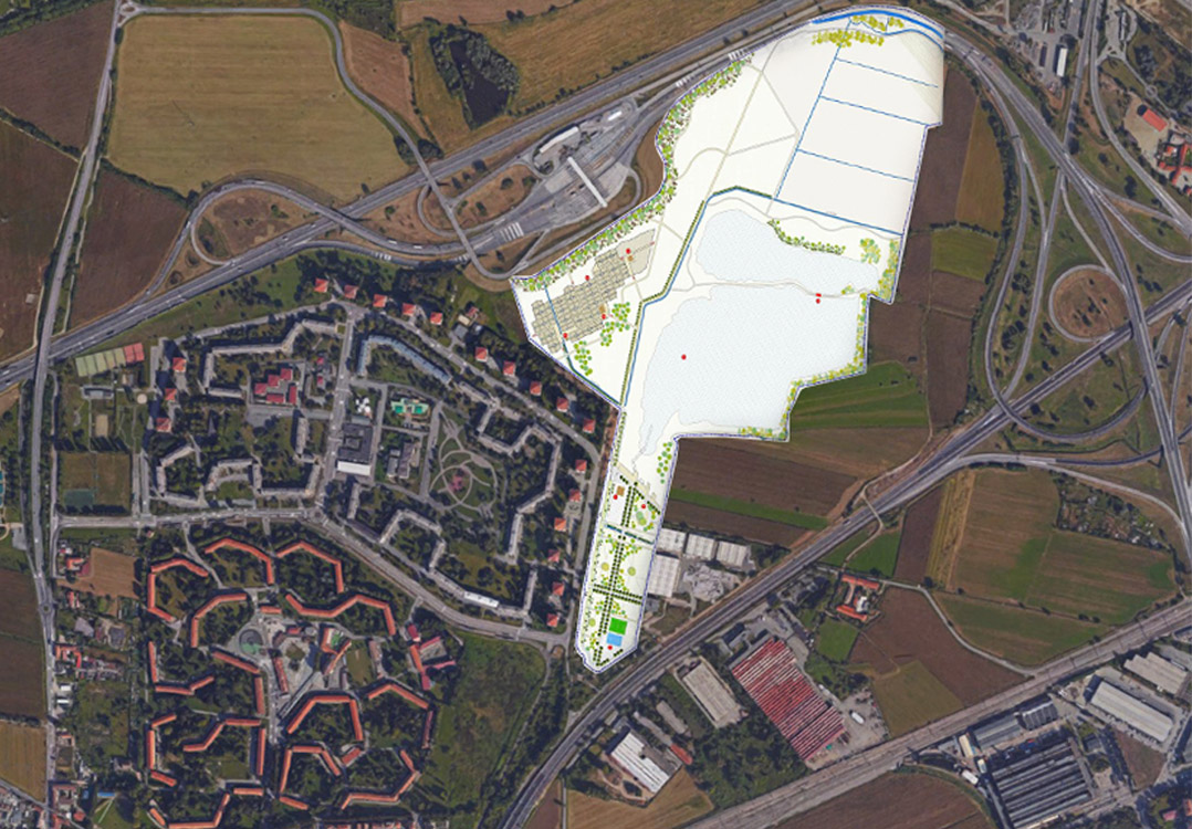
Il progetto Laghetti Falchera prevede il recupero e la riqualificazione ambientale di un'area degradata dalle attività estrattive al bordo del quartiere, che si estende per più di 45 ettari. Sono previste quattro tipologie di intervento per ottenere diverse sistemazioni del contesto non costruito: parco spondale, parco urbano attrezzato, parco estensivo e parco agricolo, con percorsi didattici, orti urbani, aree di sosta e zone attrezzate. La riqualificazione, per un costo complessivo di € 5....
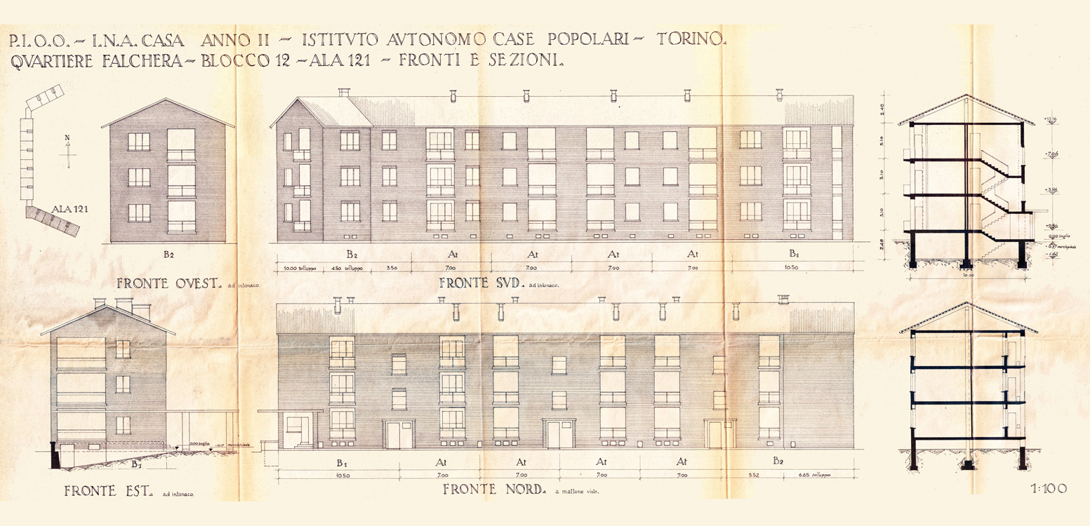
Particolari / I particolari costruttivi
Nel rispetto delle prescrizioni del capitolato generale, i progettisti interpretano e caratterizzano i blocchi residenziali attraverso le tessiture murarie, il disegno delle logge e dei parapetti, i vani scala e le distribuzioni interne.
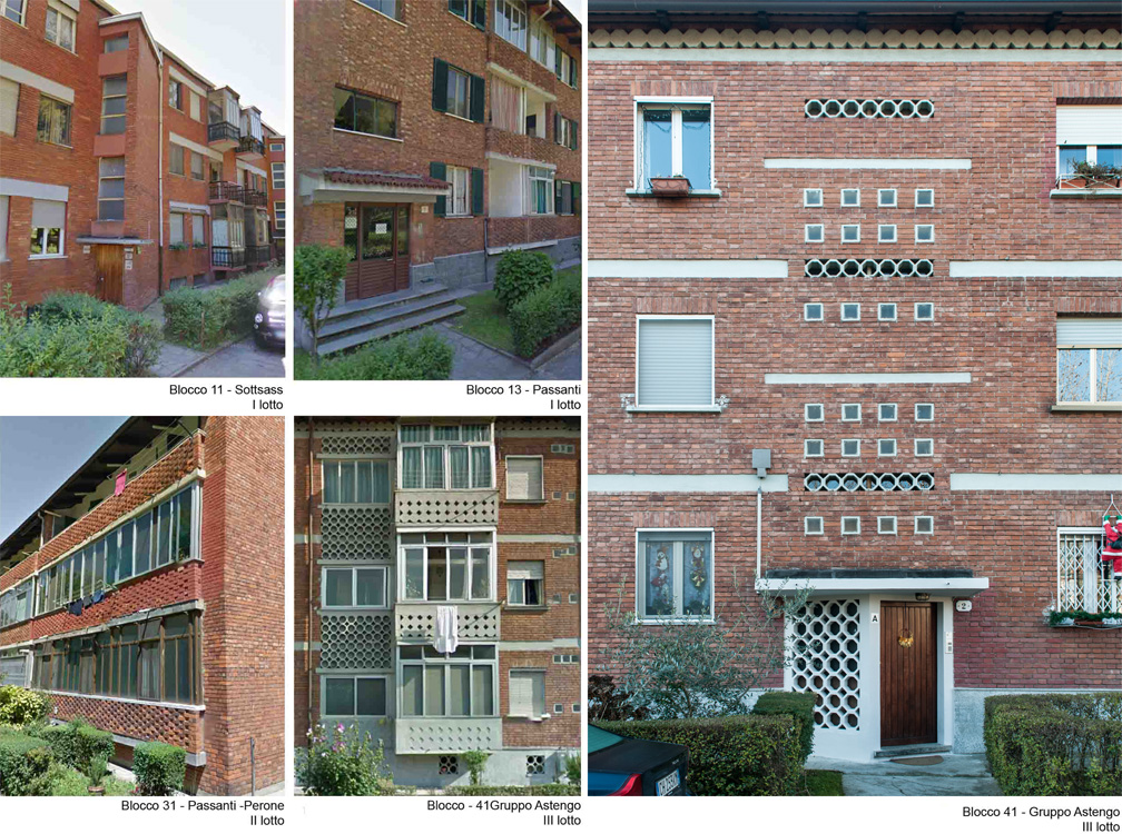
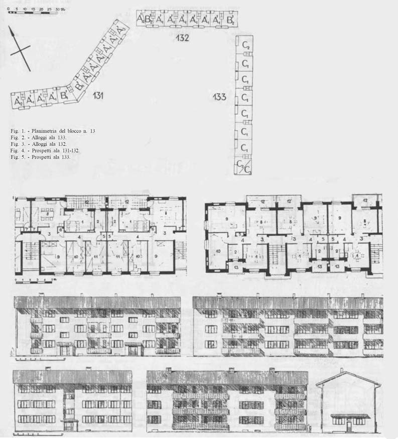
Particolari / Blocco 13
Progetto di Mario Passanti. Esempio di suddivisione interna e di caratterizzazione dei prospetti.
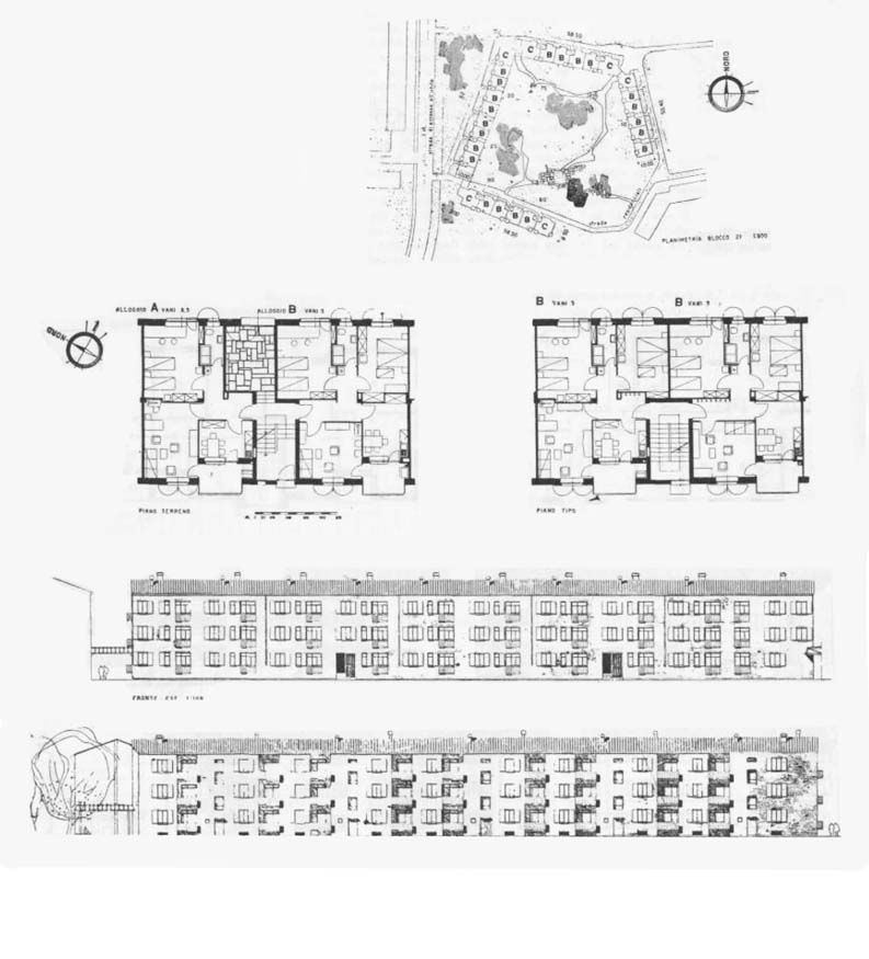
Particolari / Blocco 21
Progetto di Nello Renacco. Esempio di suddivisione interna e di caratterizzazione dei prospetti.
Particolari / Falchera 2 – l'impianto urbanistico
Il disegno di impianto del nuovo quartiere richiama l'andamento del primitivo insediamenti senza raggiungerne la qualità. Gli spazi verdi interni sono indifferenziati e i sistemi di prefabbricazione utilizzati per l'edificazione residenziale non permettono l'accuratezza dei dettagli.
Racconti / Un set cinematografico
Il quartiere è nel tempo set di numerosi film e cortometraggi da "Esterina" di Carlo Lizzani del 1960 a "A che punto è la notte" tratto dal romanzo di Fruttero e Lucentini fino ai più recenti "Dopo Mezzanotte" di Davide Ferrario (2004) e l'opera prima di una giovane ragazza rom che realizza il suo "Io Rom Romantica" presentato nel 2014 con grande successo al Giffoni Film Festival.
Racconti / Suoni e immagini di Falchera
Falchera è oggetto di campagne fotografiche e di interpretazioni del paesaggio urbano e delle periferie. Nella foto l'immagine di apertura dell'iniziativa Suoni e immagini di Falchera – El Barrio 1 del giugno 2014, dal titolo "Le città degli invisibili".
Racconti / Gente di Falchera
L'isolamento del quartiere produce una vivace attività associativa. Gente di Falchera nasce nel 1993, produce il mensile omonimo, che è strumento del "Laboratorio di Quartiere Falchera" e delle associazioni che ve ne fanno parte.
Licenza
Condividi
![]()
![]()
Permalink: