Via Po Torino

La via porticata che collega piazza Castello al fiume, asse portante del secondo ampliamento della città, alla fine del Seicento.
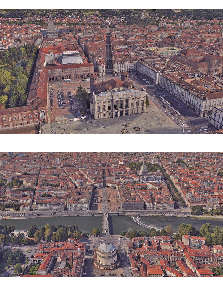
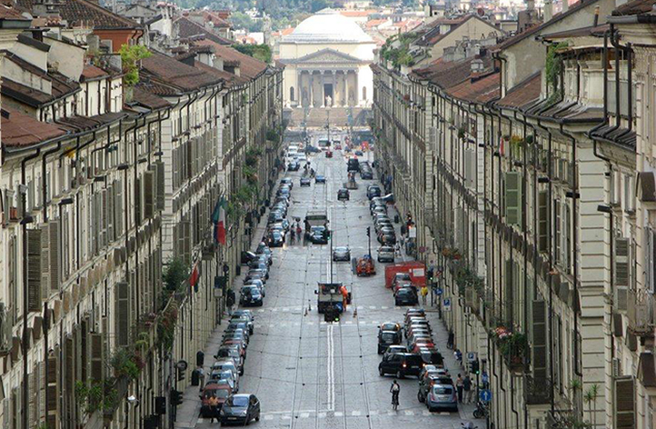
Una grande strada ricca di commerci, edifici pubblici, chiese e palazzi. Progettata nel tardo XVII secolo così come è rimasta sino ad oggi, delimitata da facciate di architettura uniforme e con due sistemi porticati continui. La via crea un cannocchiale prospettico unico, scendendo con il fondale della Gran Madre di Dio e della collina e viceversa, salendo, con lo sfondo austero del Castello.
Informazioni a cura di:
Andrea Terranova, Giorgia Senini, Martina Savi, milli paglieri, Staff Landscapefor (2016-2025)
Coordinate geografiche:
45.0673° 7.6915°
Tag:
#portico, #barocco, #storia, #locale, #architettura, #xvii-sec, #amedeo-di-castellamonte, #carlo-emanuele-ii, #collina, #madama-reale, #arte, #maria-giovanna-savoia-nemours, #torino, #urbano.POI correlati:
Media presenti
Contesto / Un asse portante della città
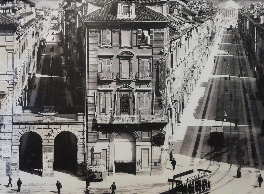
La strada, costruita con notevoli mezzi e sin dall'inizio completamente porticata, è sempre stata un asse del commercio e dei servizi più prestigiosi della città. I “porti dla pieuva” consentivano di passeggiare all'asciutto dal Palazzo al Po. Nel tempo la capacità attrattiva di Piazza Vittorio, del Po e dell'Università ha mantenuto alto il flusso dei passanti lungo tutto il percorso.
Una foto di fine 1800 ripresa dal Castello, che evidenzia la diagonale.
Storia / Una grande operazione urbana
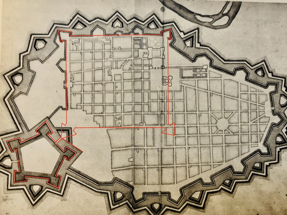
L'immagine della Città di Torino già ampliata verso il Po, mostra in rosso i confini della città romana e della cittadella
Storia / L' "eccezione" della via storta
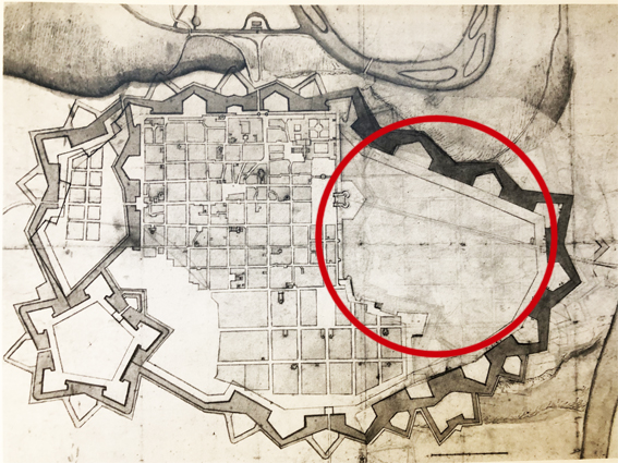
L'andamento diagonale della via rispetto al reticolo della città antica è dovuto a diversi fattori: la scarpata sulla Dora, che determina il nuovo andamento delle Mura, diagonali e parallele alla nuova via; la necessità di collegare il Castello con il ponte esistente sul Po; la volontà di mantenere la Chiesa di San Francesco da Paola e il convento dei Frati Minimi, già esistenti.
Storia / Una main street pensata a tavolino
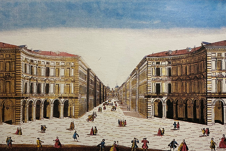
Nell'incisione di Antoine Aveline su disegno di Filippo Juvarra, la via, vista dalla piazza sul Po, si allarga nell'esedra, conclusione dell'asse castellamontiano.
Storia / I porti dla pieuva
Nell'immagine si vedono bene le terrazze tra gli edifici che consentono la totale copertura del percorso e servono anche a mascherare il forte dislivello della strada.
Storia / Le distruzioni della guerra
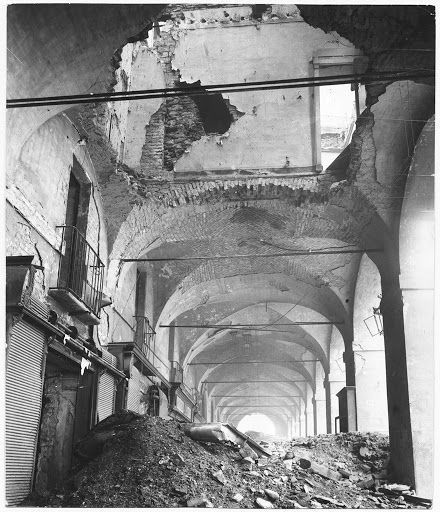
I danni della guerra sono piuttosto importanti. I bombardamenti del''43 e '44 radono al suolo diversi edifici, in particolare sul lato destro della strada. Si decide di ricostruire gli isolati mantenendo i caratteri architettonici di facciata sulla via Po. Unica differenza: i portici nei tratti ricostruiti avranno soffitti piani e non voltati. Nei retri sono invece previste architetture moderne, come nel caso del palazzo della Rai in via Verdi o del grande condominio in via Accademia Albertina.
Architettura / Un disegno di grande respiro
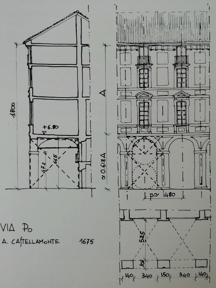
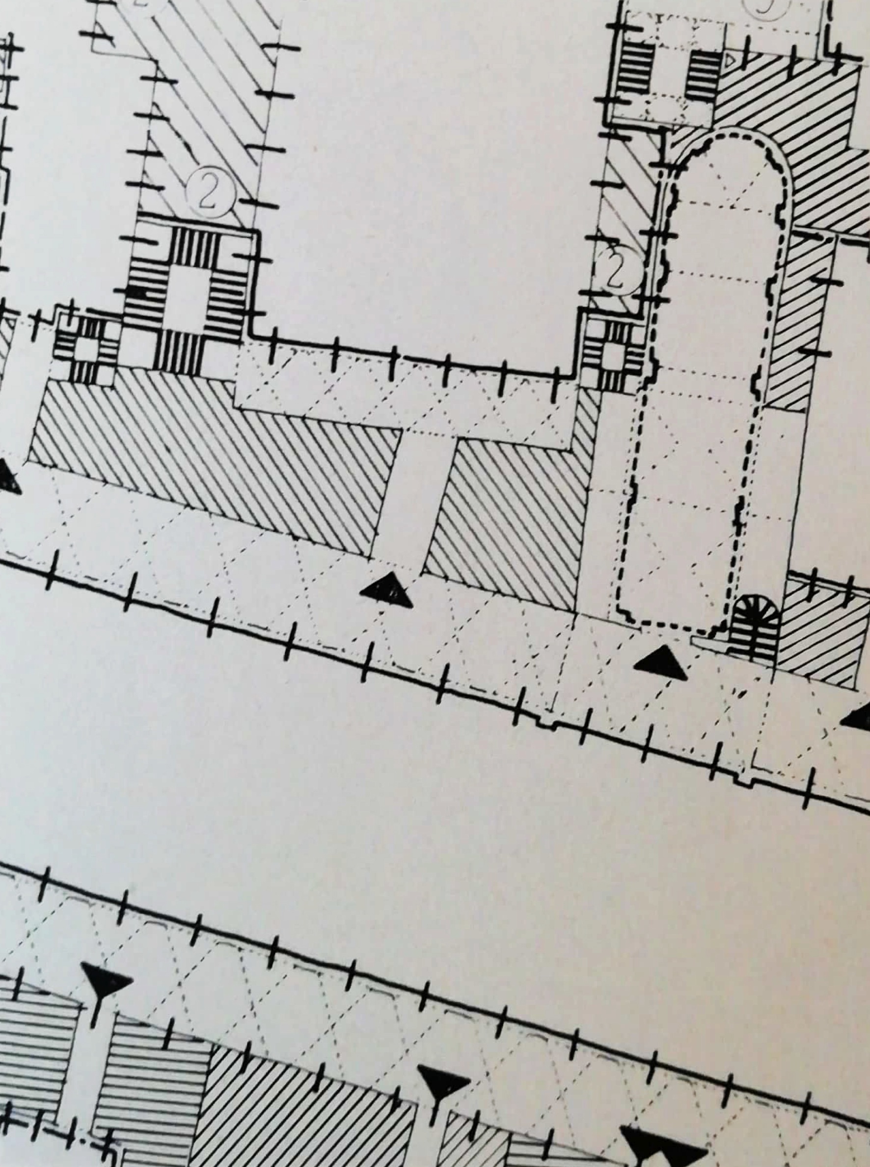
Lo schema della facciata porticata viene confrontato con quello delle altre parti poticate del centro, nel bel lavoro di Coppo e Davico del 2001
Architettura / Palazzi e case d'affitto
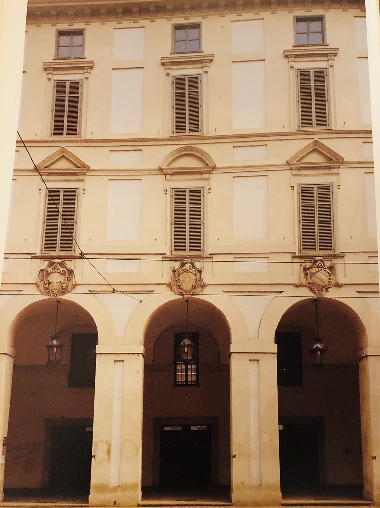
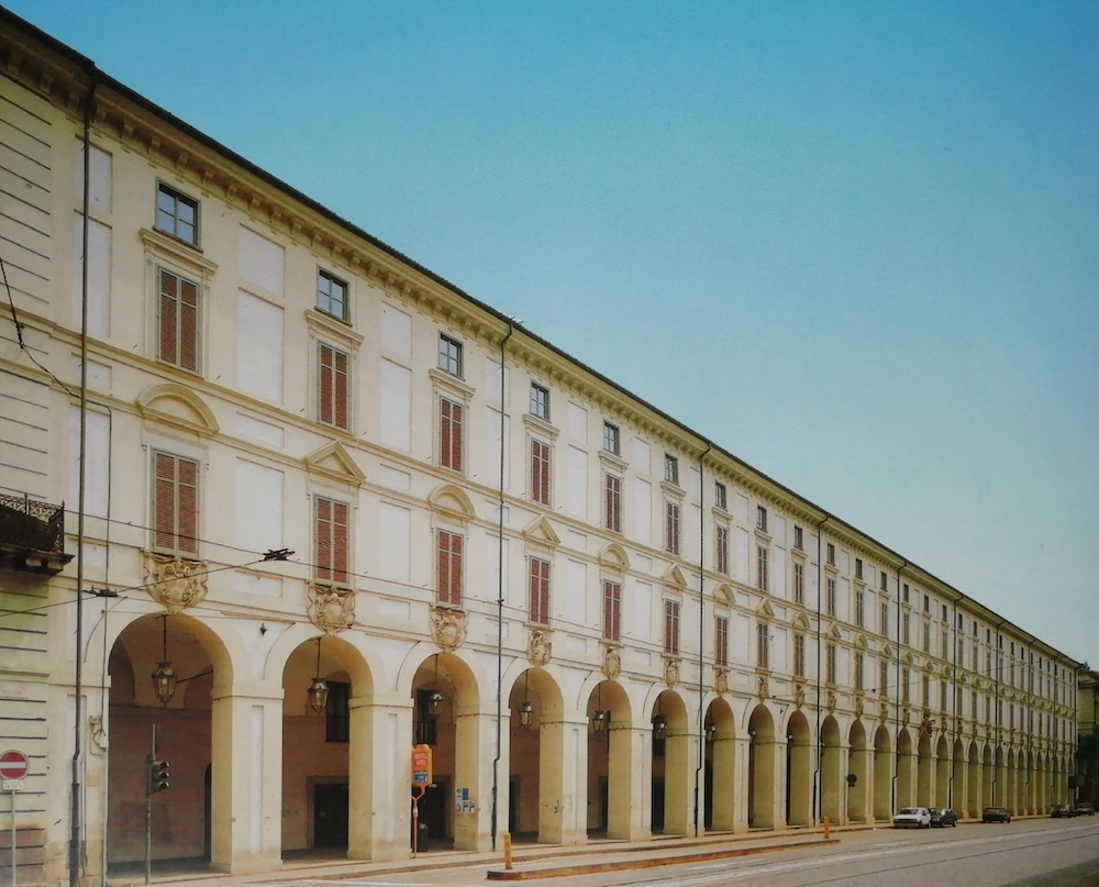
Anche il Palazzo degli Stemmi rispetta le proporzioni di facciata, la partitura tra i piani, gli assi delle finestre. Unica decorazione aggiunta: gli stemmi nobiliari delle famiglie piemontesi.
Architettura / Sopra la linea di gronda
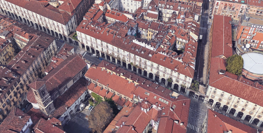
Nell'immagine si ha una visione delle molteplici e varie superfetazioni sorte nel tempo sui tetti della via.
Progetti / Il progetto della Contrada di Po
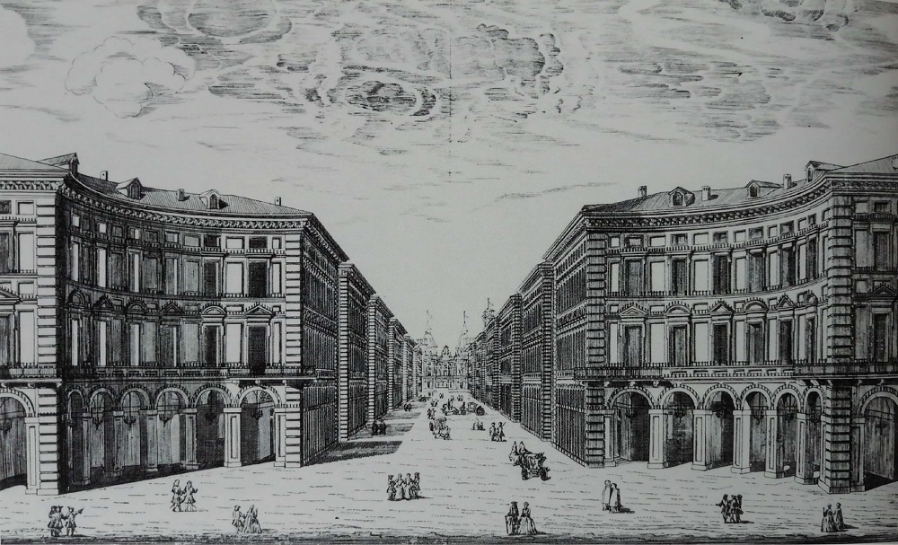
Nell'incisione del 1770 circa una veduta d'insieme della contrada di Po e dell'esedra, in cui viene esaltata l'uniformità e la regolarità delle fronti degli isolati
Progetti / La piazza Carlina
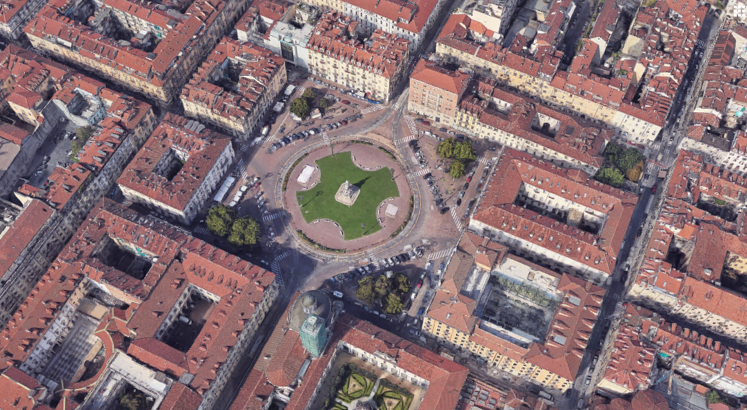
La piazza del secondo ampliamento non si trova sull'asse principale, via Po, ma sull'asse di via Maria Vittoria che la collega alla piazza Reale (piazza San Carlo).
Eventi / Carri allegorici e manifestazioni
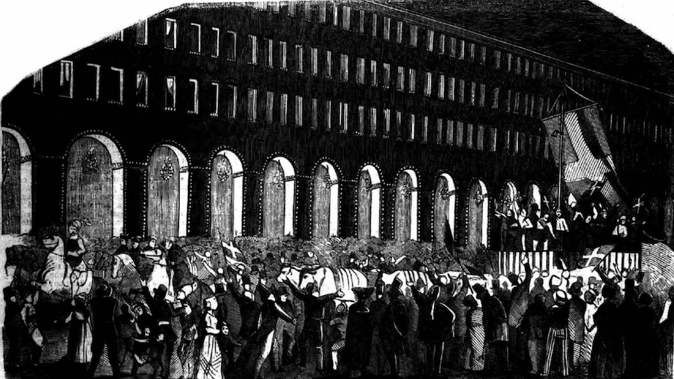
Incisione da "Il mondo illustrato" rivista del marzo 1848, con il Carroccio di Carnevale che passa nella notte lungo via Po
Particolari / Lungo via Po
Un video suggestivo, che percorre tutta via Po, sorpassa il ponte Vittorio Emanuele I e la chiesa della Gran Madre, poi risale lungo la collina e raggiunge Villa della Regina, in tutto il suo splendore.
Particolari / Sotto i portici: antiche vetrine e nuove attività
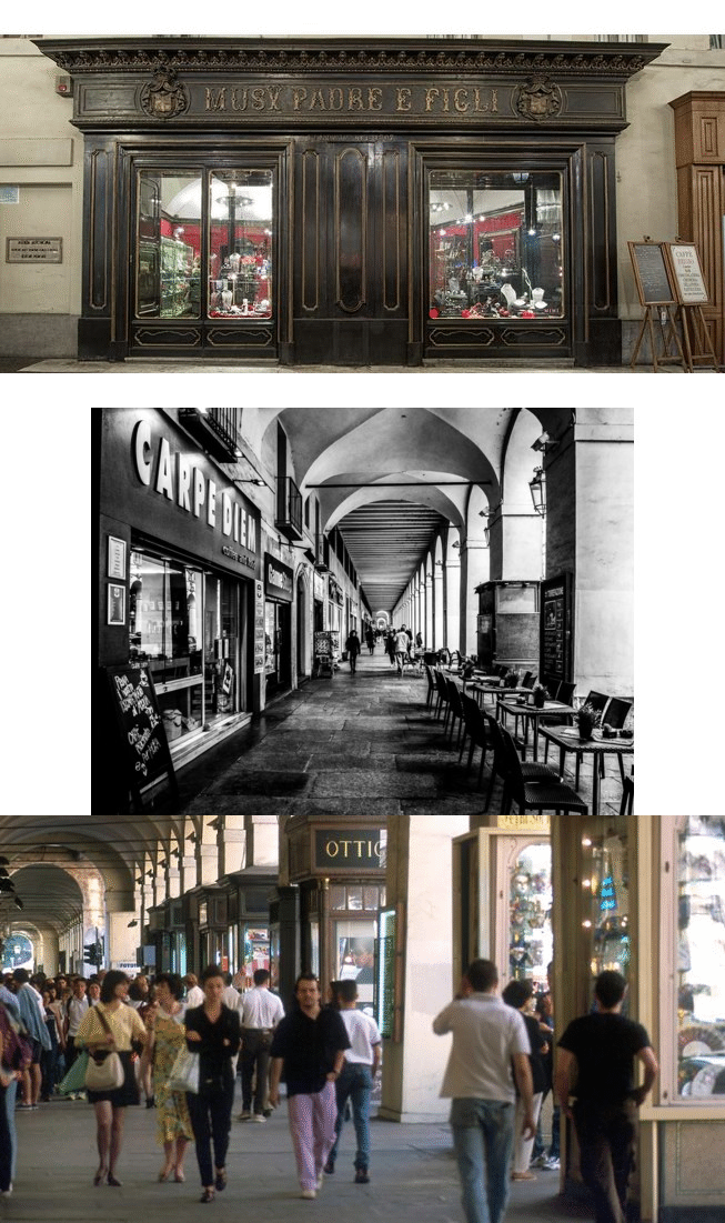
Se dal centro strada si percepisce un asse urbano memorabile, per il visitatore il luogo di maggior fascino sono i portici. Molte vetrine e dévantures sono ancora quelle ottocentesche, come il negozio Musy - orologiai e orefici della Real Casa - la profumeria dell'Università, la Cartoleria Economica, il negozio di musica Augusta... Il ritmo dei portici è sottolineato dalle edicole (per lo più di libri usati) che la sera si rinserrano attorno ai pilastri.
Particolari / L'Università tra Istituzioni del Re e Città
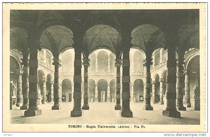
La corte del Palazzo, tra le più sontuose della città, è frutto di progetti successivi, come raccontato nella scheda di POI dedicata (La sede storica dell'Università)
Particolari / Il convento dei Frati Minimi
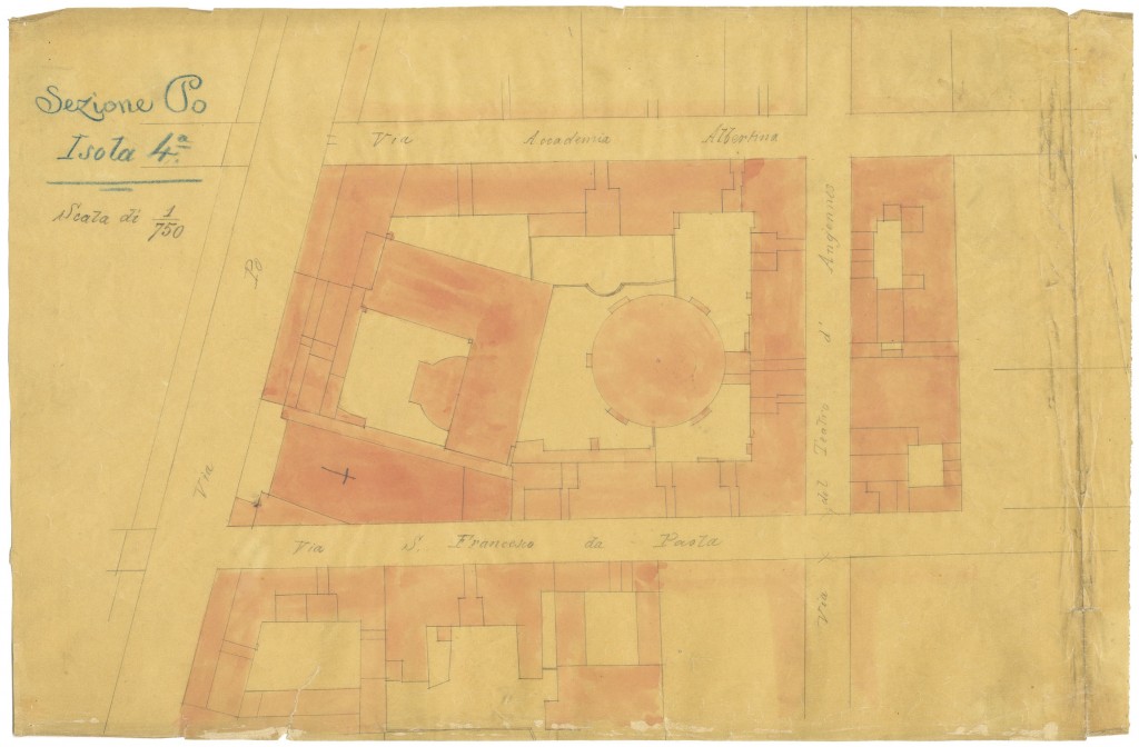
L'isolato di via Po occupato interamente dal Convento dei Frati Minimi e dalla Chiesa di San Francesco da Paola.
Particolari / Il Palazzo degli Stemmi
Il lungo fronte omogeneo del Palazzo degli Stemmi, dopo il restauro di fine secolo scorso.
Particolari / Il convento degli Ospedalieri di Sant'Antonio
Nell'ultimo isolato del lato sinistro di via Po si trovava il convento degli Ospedalieri di Sant'Antonio, con una chiesa trasformata nel 1750 su progetto dell'architetto Bernardo Vittone. Davanti alla chiesa avveniva la benedizione degli animali. Il convento e la chiesa vengono abbattuti nell'Ottocento e sull'area si costruisce un palazzo per la sede della Guardia del Corpo. Oggi si trova il Museo di Arti decorative della Fondazione Accorsi-Ometto. Tra due colonne di pietra, probabile ingr...
Particolari / Il Caffè Fiorio
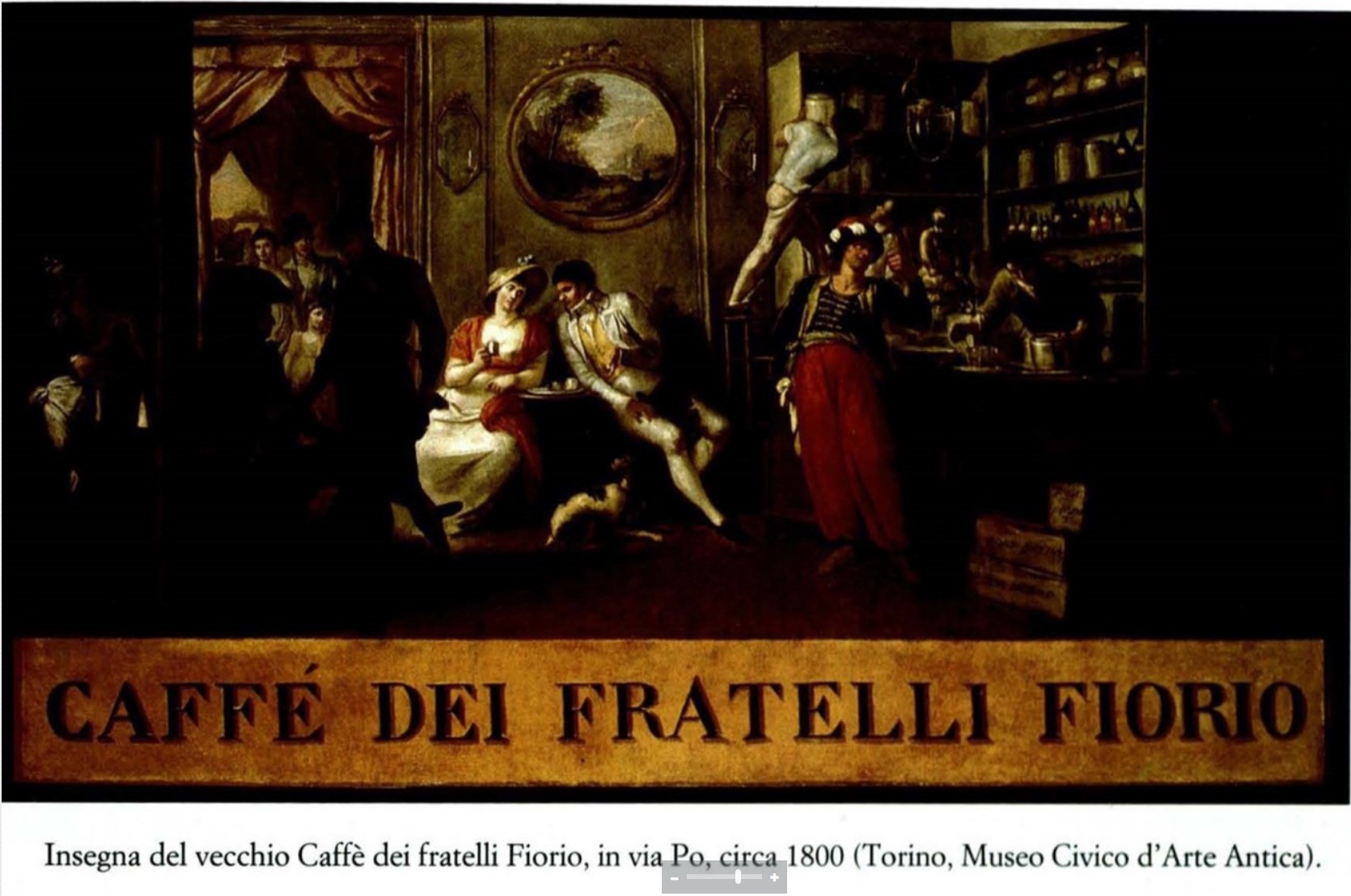
Sono molti i caffè che nella via Po hanno costituito importanti luoghi di incontro nella vita della città sin dal 1700. All'angolo con via Bogino si trova il Caffè Fiorio, già ritrovo elegante della buona società torinese, soprattutto aristocratici e intellettuali, per questo detto anche “il caffè dei codini.” Il periodo d'oro è quello in cui si decidono i destini futuri d'Italia. E i frequentatori sono certi di raccogliere qui le primizie di quanto avviene in società, ma anche nei ministeri...
Particolari / Il Caffè Nazionale
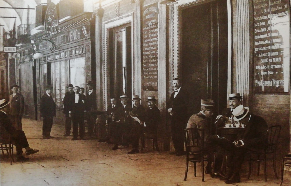
Sul lato destro di via Po, all'angolo con via Accademia Albertina, si trova il Caffè Nazionale, un tempo chiamato “delle Colonne” per via di una colonna triangolare con specchi che stava in mezzo alla sala. E' stato uno dei primi locali ad essere arredato con specchi lungo le pareti. Molto frequentato in periodo pre-risorgimentale, diviene ritrovo di quanti erano animati da grandi speranze; qui Roberto d'Azeglio l'8 febbraio 1848, salendo su un tavolo, preannuncia alla folla entusiasta lo St...
Particolari / Nella vecchia latteria
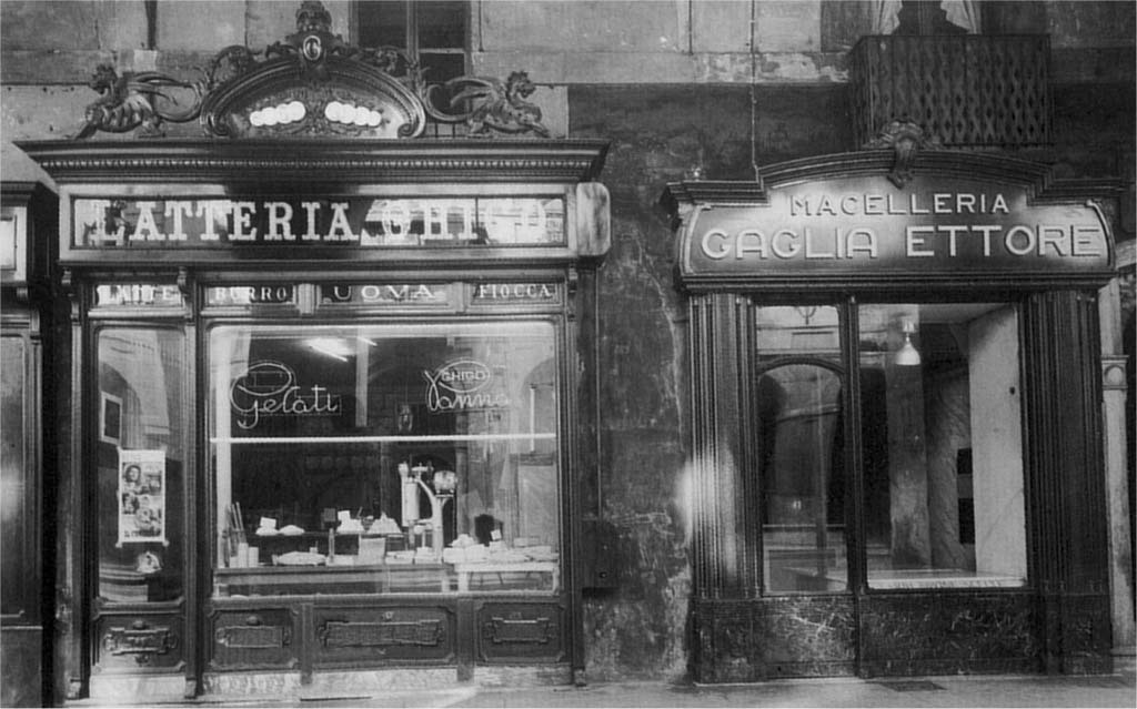
Nell'immagine l'insegna della Latteria oggi conosciuta come Pasticceria Ghigo
Approfondimenti
- Via Po in Wikipedia —l'enciclopedia libera
- Via Po in Wikimedia Commons —l'archivio multimediale libero

 Chiesa della Gran Madre di Dio