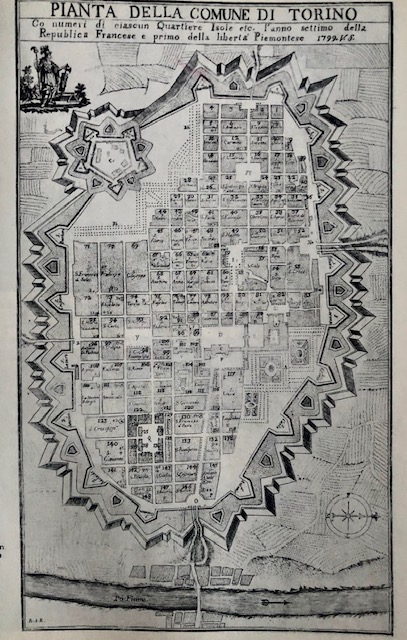
Di Beltramo Antonio Re da Ada Peyrot, Vittorio Viale, Immagini di Torino nei secoli, Torino 1973
La città a fine XVIII secolo
La pianta di Torino del 1799, redatta sulla base dell'incisione di Beltramo Antonio Re, riporta alcune modifiche rispetto alla precedente del 1751, del medesimo autore. Via Milano appare completata con lo slargo a losanga davanti alla Basilica Mauriziana realizzato; quasi terminata appare anche la via Corte d'Appello. Il progetto alfieriano di via e piazza Palazzo di Città è in corso di realizzazione, ma manca ancora l'ampliamento del palazzo municipale. La pianta, oltre al nome dei santi, riporta il numero degli isolati. Dal numero 1 al 18 sono quelli del terzo ampliamento, di nuova realizzazione, compresi tra i Quartieri Militari juvarriani e la piazza Savoia.
Nella pianta del 1799 è riportato in alto a sinistra lo stemma della Repubblica Cisalpina e la scritta ".. l'anno settimo della Repubblica Francese e primo della libertà Piemontese"
Calendario eventi:
Centri urbani
