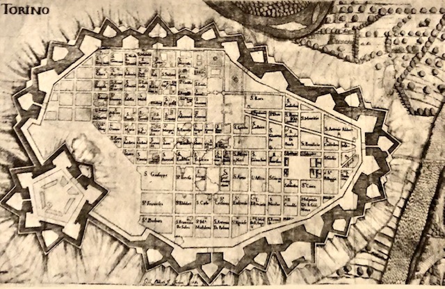
Di Giovanni Abbiati da Ada Peyrot, Vittorio Viale, Immagini di Torino nei secoli, Torino 1973
Il progetto unitario della città nella cartografia di fine Seicento
Nella cartografia di fine Seicento appare chiaro il progetto unitario della città. I nuovi ampliamenti e le riplasmazioni della parte occidentale dovevano innestarsi sul tessuto esistente, in continuità con la maglia a scacchiera, con criteri compositivi analoghi ai precedenti ampliamenti a sud e a est (via Roma e via Po), perseguendo e arricchendo il disegno d'insieme. Seppure realizzati in tempi diversi, i quattro interventi settecenteschi nella parte ovest - via di Porta Palazzo (via Milano), via Corte d'Appello, via Dora Grossa (via Garibaldi) e piazza delle Erbe (via e piazza Palazzo di Città) saranno considerati parte del disegno generale della città, nel più totale spirito identificativo della rappresentazione della capitale.
La pianta del 1680 è ritenuta la prima stampa della città con l'assetto completo delle fortificazioni e la scacchiera degli isolati.
Calendario eventi:
Centri urbani
