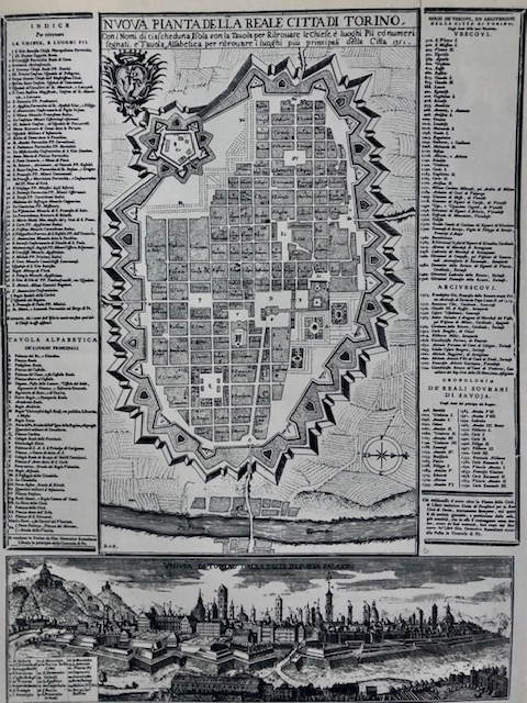
Di Beltramo Antonio Re da Ada Peyrot, Vittorio Viale, Immagini di Torino nei secoli, Torino 1973
La città a metà del XVIII secolo
Nella carta di Torino del 1751 sono compresi gli ampliamenti della zona ovest della città. Sono completati gli isolati del nuovo, terzo ampliamento, dai Quartieri militari juvarriani alla piazza Susina, mentre quelli a est della piazza, di impianto medioevale, risultano in parte ancora da allineare lungo l'asse principale di via Corte d'Appello. In via Milano vediamo completata solo la prima parte, Porta Palazzo e i primi due isolati alle spalle della piazza. Via e piazza Palazzo di Città attendono ancora l'intervento di Alfieri, mentre via Garibaldi, almeno nella mappa, appare già rettificata. Bisognerà attendere tuttavia gli ultimi decenni del XVIII secolo per vedere il suo completamento.
Nella pianta di B.A.Re del 1751, gli isolati sono distinti dai nomi dei santi, usanza che si manterrà per tutto il secolo. Sui lati della pianta si trovano gli elenchi delle chiese, dei luoghi principali, dei vescovi e arcivescovi, dei reali sovrani di
Calendario eventi:
Centri urbani
