Di Carlo Domenico Serena da Madame Reali, cultura e potere da Parigi a Torino
Il controllo preciso del disegno urbano
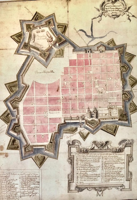
In una pianta eseguita verso la fine del secolo XVII che comprende un elenco dei proprietari dei lotti, si può riscontrare la consistenza e la definizione dell'ampliamento. La "città nuova"si forma attraverso un disegno preciso, determinato dal potere centrale, in particolare dalla Madama Cristina, con lungimiranza funzionale alle esigenze militari e amministrative. La lottizzazione dei terreni testimonia il controllo sull'immagine della città, ma anche sulle destinazioni degli isolati. Alle famiglie nobili vengono donati i terreni affinchè realizzino i loro palazzi secondo il disegno prestabilito, i molti ordini religiosi, chiamati in città dalla sovrana, contribuiscono a colmare i vuoti e a completare il disegno che si arricchisce di chiese, conventi e giardini.
La pianta della città è probabilmente dedotta da un disegno di Carlo di Castellamonte. Oltre a definire con precisione l'andamento delle fortificazioni e la definizione degli isolati, riporta i nomi di proprietari e gli edifici e i conventi più importanti
Calendario eventi:
Centri urbani
