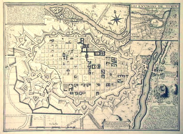
Di Charles Inselin da © Archivio Storico della Città di Torino
La città nelle carte di fine Seicento
Nelle carte di fine Seicento si coglie la necessità di rappresentare una città ordinata, con la rigida scacchiera degli isolati che garantisce una forte continuità con la città vecchia. Il nuovo ampliamento e le riplasmazioni del tessuto antico, previste nella parte occidentale, si innestano sul tessuto esistente, con criteri compositivi analoghi agli ampliamenti a sud e a est (via Roma e via Po), perseguendo e arricchendo il disegno generale, profondamente rappresentativo della dignità regale.
Nell'incisione di fine Seicento si legge la scacchiera degli isolati che prosegue anche nella parte ovest della mandorla delle mura. La costruzione dei nuovi isolati inizierà soltanto negli anni venti del XVIII secolo.
Calendario eventi:
Centri urbani
