 Montalenghe Montalenghe

Di Google Maps
Una fitta rete geografica
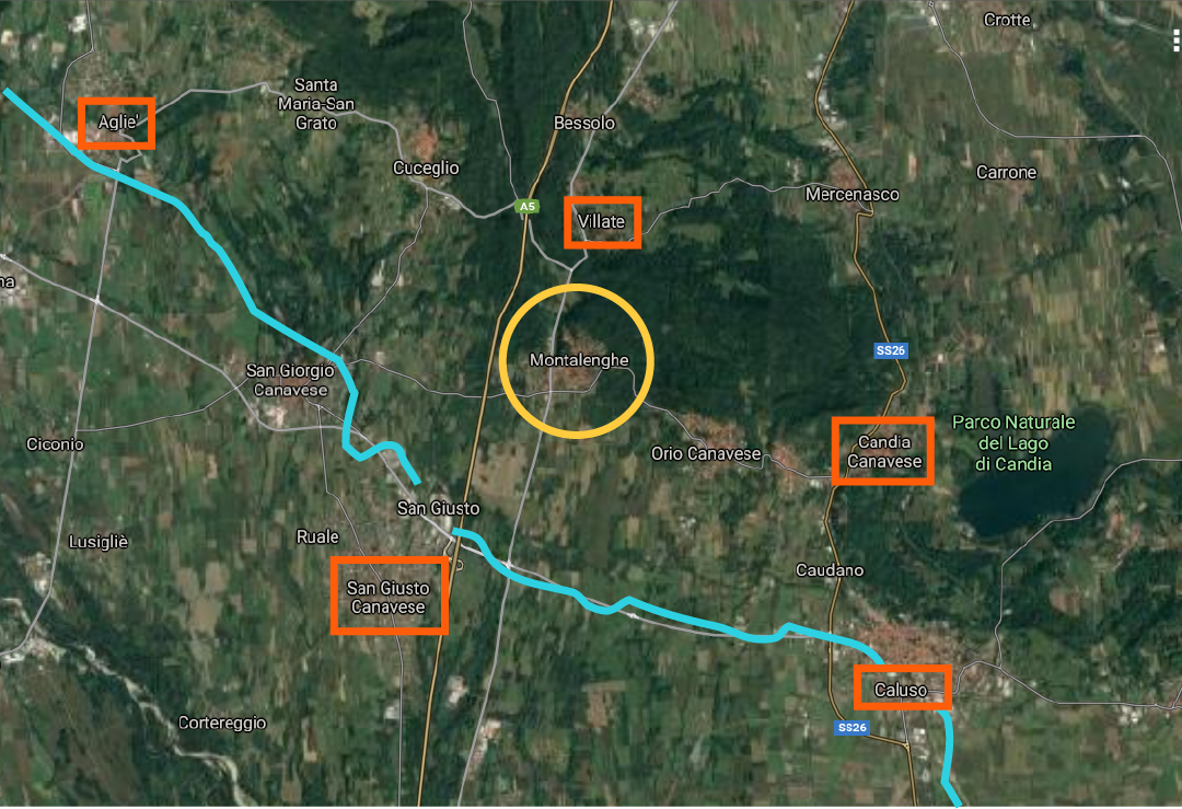
Montalenghe fa anche parte del più ampio quadro della Serra Morenica di Ivrea, il rilievo di origine glaciale inserito nell'Anfiteatro Morenico. Il comune costituisce pertanto uno dei tanti tasselli che compongono la geografia canavese. Ad unificare questa realtà sfaccettata vi è il Canale di Caluso, celebre sistema di irrigazione storico lungo ben 28 km. Di questa grande rete fanno parte i limitrofi comuni di Agliè, Villate, San Giusto, Candia e Caluso.
Un'immagine satellitare dei dintorni di Montalenghe (cerchiata in giallo): i rettangoli rossi evidenziano i comuni limitrofi, mentre la linea azzurra indica il Canale di Caluso.