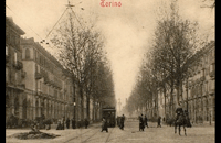
Corso Vittorio Emanuele II Torino

Lungo più di quattro chilometri, uno degli assi dell'espansione otto-novecentesca, al bordo della cinta storica della città
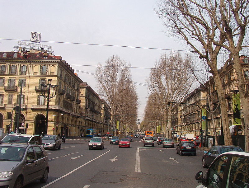
Un corso disegnato con il titolo di Viale del Re, per le dimore aristocratiche tra Porta Nuova e Po. Torino di fine 1800 esce con ordine e dignità dalla cinta delle mura e diventa asse direttore di una dimensione urbana moderna. E' stato la dorsale principale dell'ampliamento della città borghese, spinto dall'attestamento ferroviario di Porta Nuova e dai quartieri qualificati intorno alla stazione, ben connesso con il telaio urbano della città antica e con gli assi di sviluppo verso sud, lungo la collina e verso Corso Francia.
Informazioni a cura di:
Giulietta De Luca, Martina Savi, milli paglieri, Staff Landscapefor (2018-2025)
Coordinate geografiche:
45.0613° 7.6829°
Tag:
#architettura, #vittorio-emanuele-ii, #abitazione, #urbano.POI correlati:
Media presenti
Contesto / Da bordo urbano a asse centrale
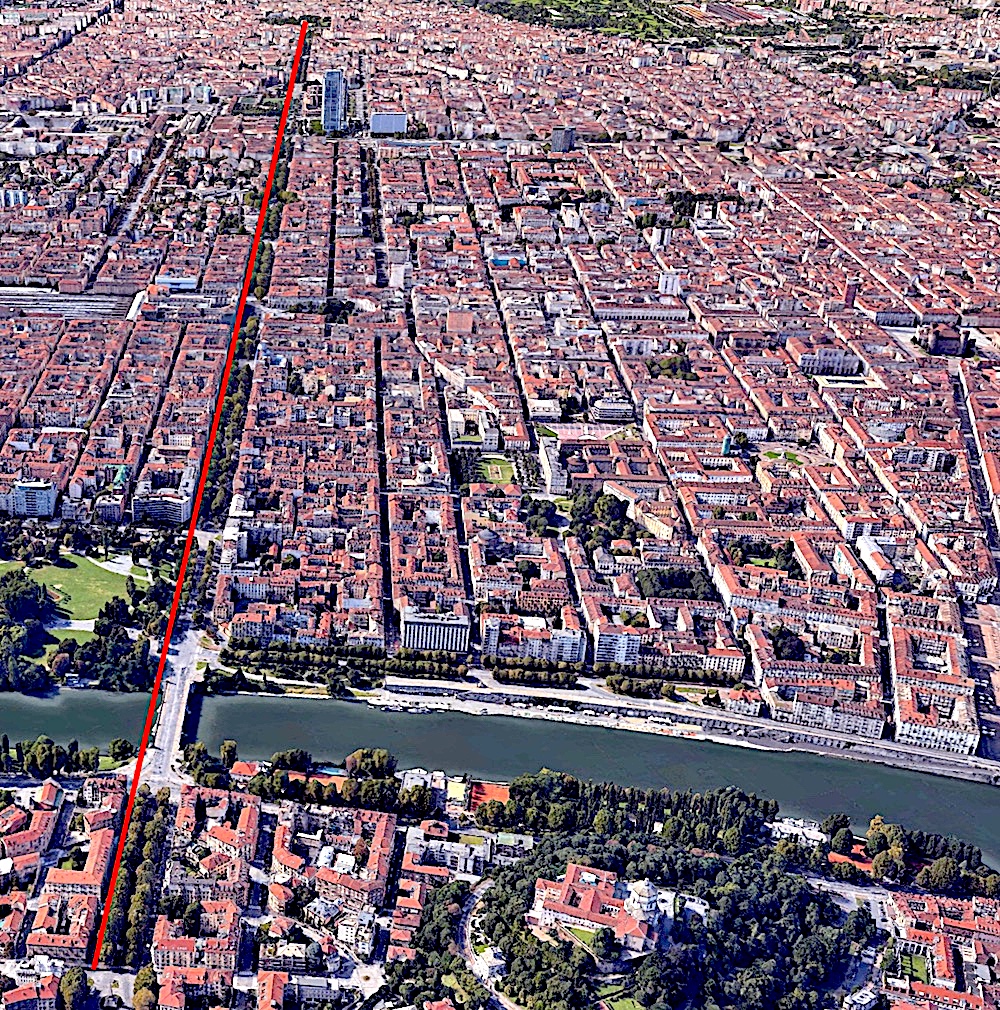
Dall'immagine di google earth si vede l'asse di bordo ottocentesco trasformato in asse di simmetria di una città continua: l'impianto urbano precedente è stato "specchiato" nel 1900 oltre Porta Nuova.
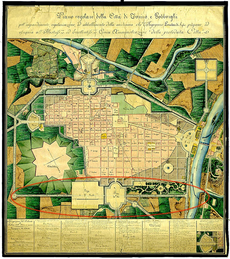
Nella mappa Porta Nuova e il Viale del Re sono sottolieati conl'ellisse rossa
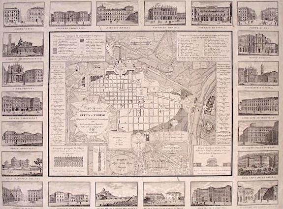
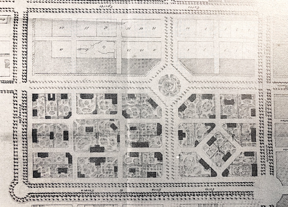
Nella pianta con alcune vedute dei principali edifici della città-(disegno di Lombardi 1817) si leggono già le tracce degli isolati da costruire, al posto del precedente progetto di Parco.
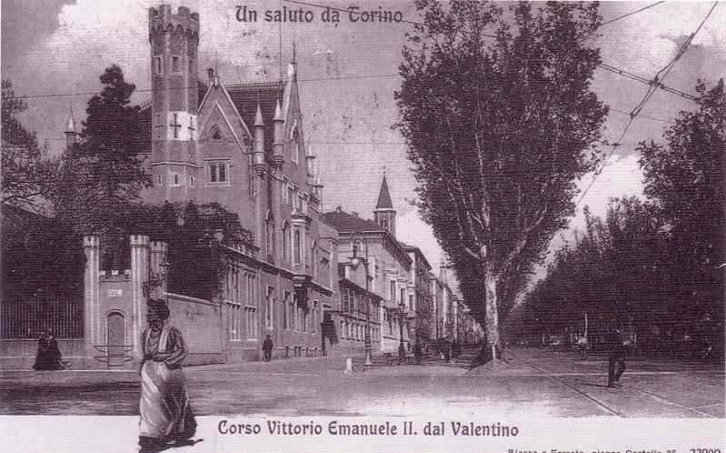
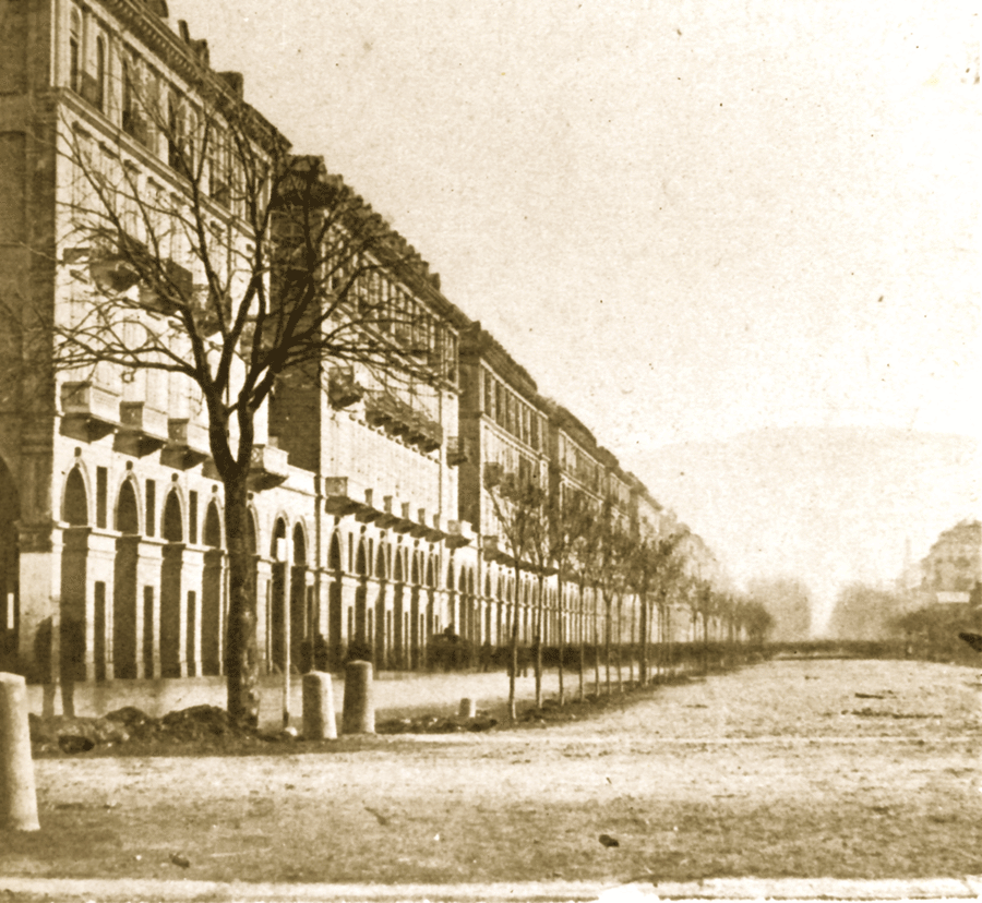
Quando corso Vittorio era ancora Viale del Re e non era asfaltato
Storia / Il Viale del Re prosegue verso ovest
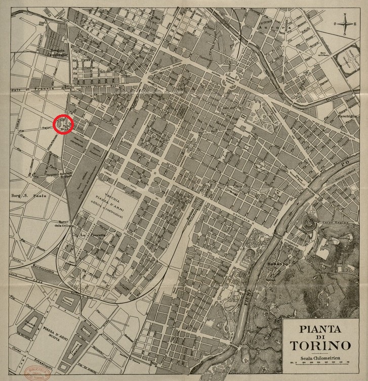
Carta del 1910 circa, in cui è visibile che il corso non era ancora completo. Il progetto del proseguimento è dal cerchio rosso in poi
Architettura / Due edifici di architettura eclettica
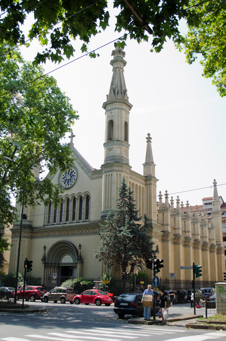
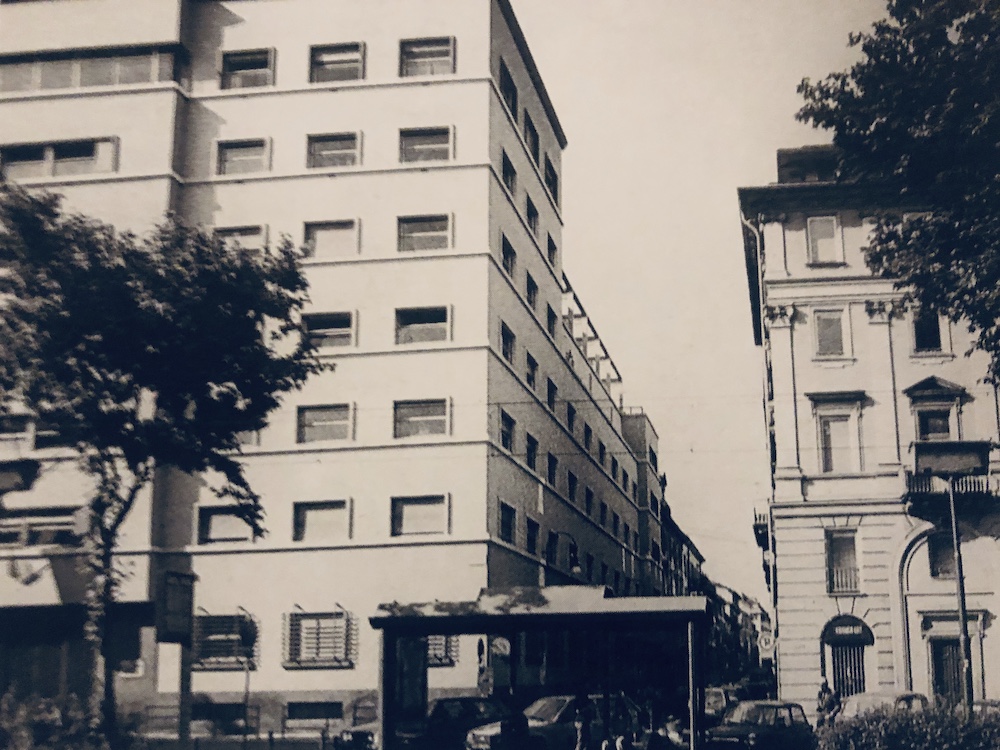
Sul fronte meridionale del primo tratto di corso Vittorio Emanuele non troviamo edifici di particolare interesse, a parte i condomini progettati a fine anni Cinquanta dall'architetto Gualtiero Casalegno, nel primo isolato, tra corso Massimo d'Azzeglio e via Ormea. Procedendo verso la Stazione, incontriamo due architetture di gusto eclettico: la chiesa popolarmente detta di San Giovannino, con disegno in stile romanico, di Edoardo Arborio Mella del 1878 con l'attiguo Istituto Salesiano e il T...
Architettura / La realizzazione del primo tratto del Viale del Re
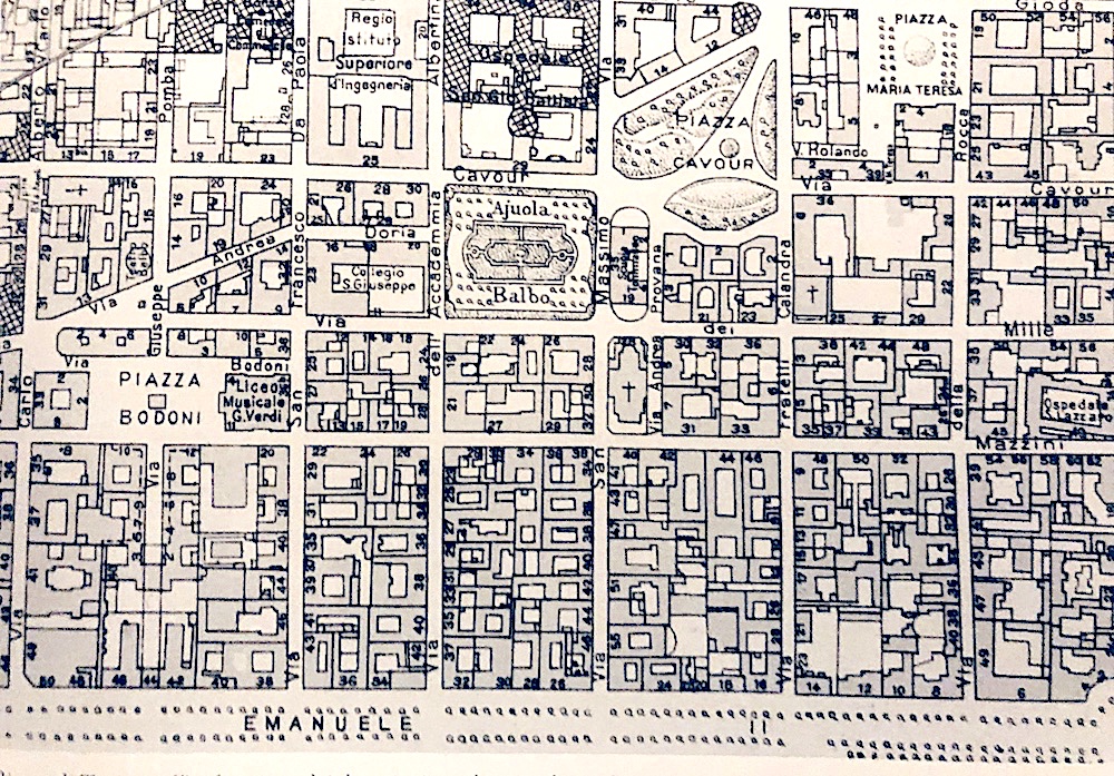
nell'immagine uno stralcio della pianta di Torino con l'indicazione dei due Piani regolatori... aggiornati sino a giugno 1935. Si nota la complessità degli isolati compresi tra il Viale del Re e la via Mazzini
Architettura / Nuove architetture al posto delle ville con giardini
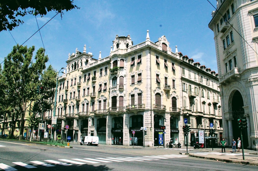
I due edifici all'angolo con via della Rocca, il Palazzo "Novecento" e l'edificio per appartamenti di fine Ottocento. Entrambi sono stati oggetto di restauri e cambio di destinazione d'uso negli ultimi anni
Architettura / Le archietture emergenti del Viale del Re
Procedendo verso ovest, il fronte settentrionale del Viale presenta architetture di diversi periodi, quasi tutte risultato di rifacimenti di edifici e ville preesistenti. Tra le più rilevanti: il caseggiato di gusto art-déco, acquistato dalla Fiat e progettato da Vittorio Bonadé Bottino negli anni Venti del Novecento, all'angolo con via Carlo Alberto; ospitava il cinema Corso, distrutto da un incendio negli anni Ottanta ed è stato in seguito ristrutturato per ospitare uffici. Sull'altro ango...
Architettura / Una palazzina con giardino
Nell'isolato compreso tra via San Francesco da Paola e via Carlo Alberto troviamo l'unico edificio che ha mantenuto un carattere di villa con giardino: la palazzina Porta-Bava, progettata dal Lombardi e poi modificata dall'Antonelli, con fronte neoclassico su via Pomba e giardino fino al Viale del Re. La palazzina viene in seguito ampliata con corpi laterali e scuderie nel giardino. A fine Ottocento, divenuto Palazzo e poi sede della Martini e Rossi, Camillo Riccio progetta un elegante fro...
Architettura / Un Piano di architettura uniforme
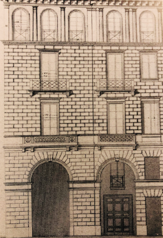
I primi progetti di edifici relativi al Piano di Ingrandimento fuori Porta Nuova del Promis vengono presentati nel 1851. In quell'anno viene definito nel dettaglio il disegno architettonico delle facciate principali degli edifici coinvolti nel Piano: ovvero quelli compresi sul Corso Vittorio, tra via Rattazzi e corso Re Umberto, le fronti delle attuali via Nizza e via Sacchi in corrispondenza degli edifici della Stazione, oltre quelli della piazza Carlo Felice. I lotti sugli affacci principal...
Architettura / Il disegno dettagliato del Promis per le facciate.
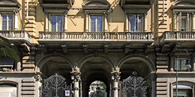
Il disegno uniforme della facciata del Promis, concepito in modo minuzioso e sapiente, è organizzato in tre parti sovrapposte: nella parte inferiore i portici, sviluppati sull'altezza del piano terreno e del sovrastante piano mezzanino, alternano aperture ad arco con altre rettangolari, sovrapposte; la parte intermedia, delimitata da cornici continue, riguarda i due piani principali della casa, con finestre alternate a balconi; l'ultimo piano si pone come un coronamento dell'edificio, con lo...
Architettura / Il completamento dei portici
nell'immagine si notano le diverse caratteristiche del nuovo Piano di Fabbricazione: a sud del Viale del Re le palazzine con giardini, a nord gli edifici con fronti portcate sui viali - più scuri - e quelli retrostanti, sulla via San Quintino, di "libera
Particolari / Le pasticcerie famose
Corso Vittorio Emanuele II, oltre che per la sua lunghezza, per il Tribunale di Giustizia e per gli splendidi edifici che vi si possono osservare, è nota anche per le ghiottonerie che vi si possono assaggiare. Una delle pasticcerie sicuramente più famose che incontriamo addentrandoci nel corso è il bar Platti, dal 1875, con i suoi delicati pasticcini dalle forme più varie. E come non menzionare Gerla, che si diletta nella preparazione di gianduiotti, macaron, torte, paste secche e fresche? ...
Particolari / I portici da Corso Vittorio ai viali limitrofi
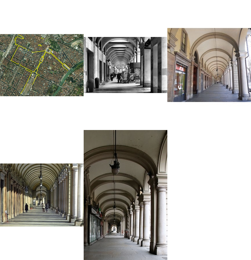
I portici di corso Vittorio integrano il grande sistema porticato della zona centrale e proseguono nei viali adiacenti, fino alla stazione di Porta Susa. Un percorso di 18 km! Di particolare interesse il tratto compreso nel Piano del Promis per la zona di Porta Nuova che si estende fino al corso Re Umberto. Il disegno dei portici, caratterizzato da un'alternanza di archi e di aperture rettangolari sovrapposte, è ancora una volta una reinterpretazione dello schema a serliane della vitozziana...
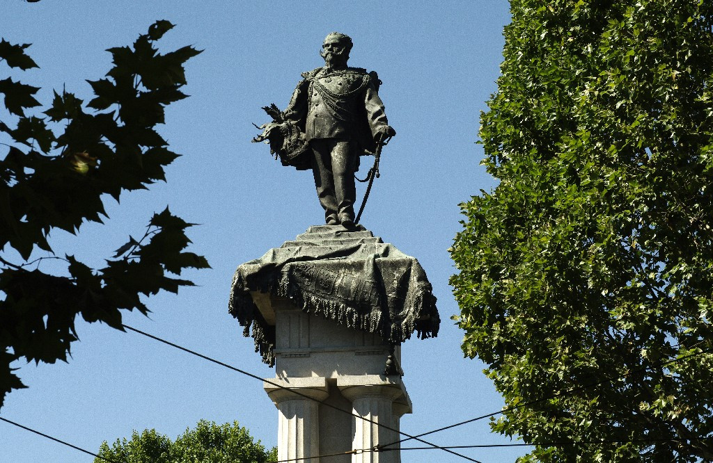
Particolari / Il monumento a Vittorio Emanuele II di Savoia
Il monumento si trova all'incrocio tra corso Vittorio Emanuele II e corso Galileo Ferraris. E' dedicato, appunto, a Vittorio Emanuele II di Savoia, che fu primo re d'Italia, e fu commissionato da Umberto I, suo figlio. La statua di Vittorio Emanuele si erge su alte colonne doriche e sotto di essa sono rappresentati l'Unità, la Fratellanza, il Lavoro e la Libertà. Essendo alto 39 metri, il monumento viene spesso chiamato "il re sui tetti" o, dai torinesi, "Barba Vigiu".
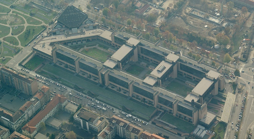
Particolari / Palazzo di Giustizia
Foto via satellite del PalaGiustizia, che ne evidenzia le grandi dimensioni
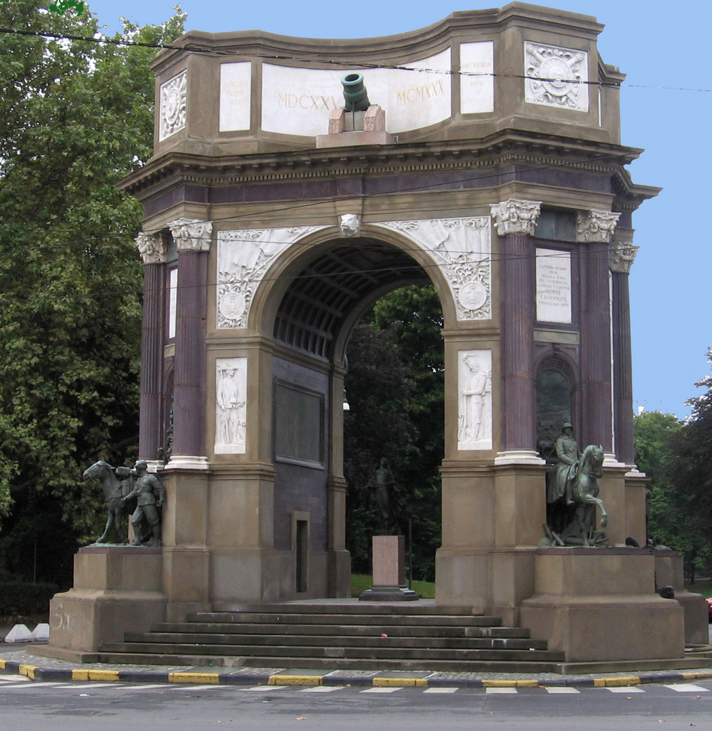
Particolari / Arco del Valentino
L'Arco monumentale all'Arma di Artiglieria (conosciuto anche come "Arco del Valentino" o "Arco di Trionfo") è un arco situato all'ingresso nord del Parco del Valentino, a qualche metro da Ponte Umberto I. Fu eretto nel 1930. L'arco mostra al suo esterno quattro rilievi ispirati ad altri corpi militari, mentre al centro dell'opera è presente una statua dedicata a Santa Barbara, patrona degli artificieri.
Racconti / Corso Vittorio nel tempo
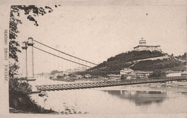
Un viaggio nel tempo nell'elegantissimo corso Vittorio Emanuele II grazie ad una splendida collezione di cartoline d'epoca.
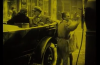
Racconti / Gli eroi del cinema come unica salvezza
Maciste (Itala Film, 1915) Regia: Vincenzo Dénizot, Romano Luigi Borgnetto
Approfondimenti
- Corso Vittorio Emanuele II in Wikipedia —l'enciclopedia libera
- Corso Vittorio Emanuele II in Wikimedia Commons —l'archivio multimediale libero

 Parco del Valentino
  Porta Nuova (stazione ferroviaria)