Borgo San Salvario Torino

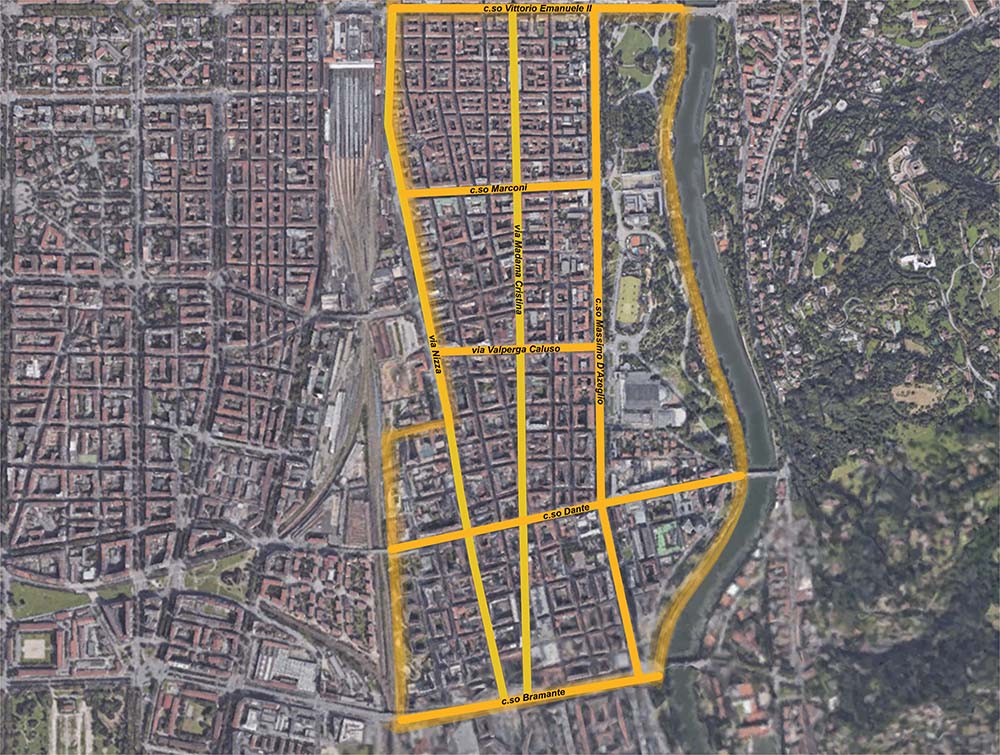
Borgo San Salvario è la prima parte urbanizzata a sud di Corso Vittorio Emanuele e si sviluppa dalla metà del 1800 tra il campo binari di Porta Nuova e il Valentino.
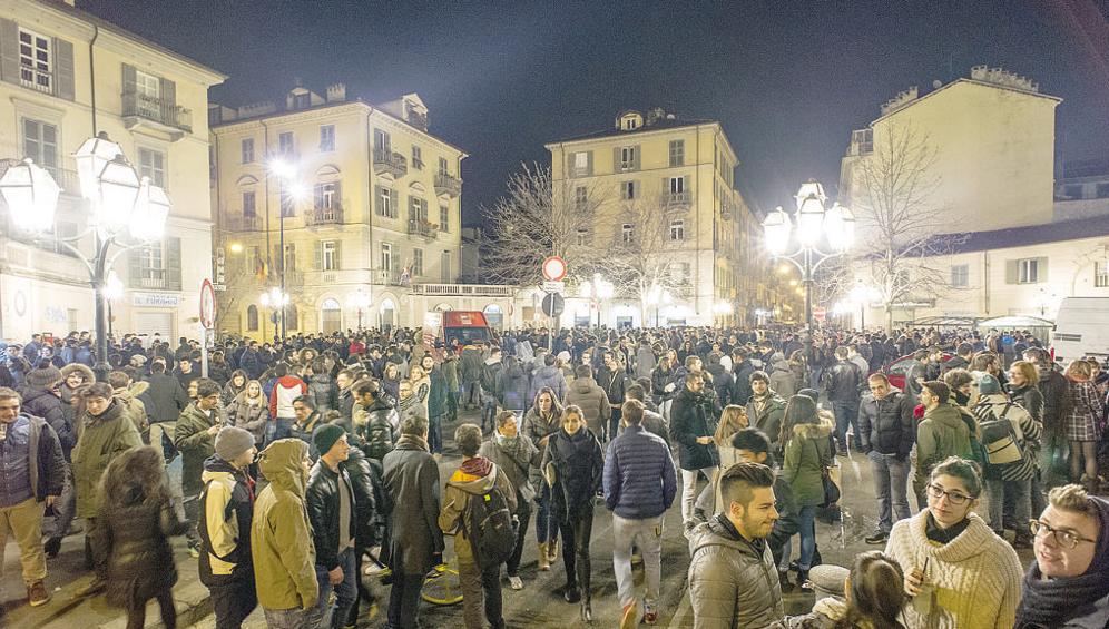
Un quartiere complesso, in parte operaio (come i coevi S. Donato e Vanchiglia), in parte borghese e commerciale (connesso all'indotto della Stazione ferroviaria ) e in parte sede di residenze alto-borghesi (lungo il Parco del Valentino). Sottoposto a degrado e a trasformazioni forti tipiche dei quartieri prossimi alle stazioni, dall'inizio degli anni 2000 ha vissuto un processo di rigenerazione con la nascita di locali e ristoranti molto frequentati dai giovani, divenendo luogo privilegiato della movida torinese.
Informazioni a cura di:
Caterina Gaspardo Moro, Martina Savi, milli paglieri, Staff Landscapefor (2018-2025)
Coordinate geografiche:
45.0562° 7.6815°
Tag:
#borgo, #arte, #contemporaneo, #urbano.
Media presenti
Contesto / Il quartiere dietro la "Porta Nuova"
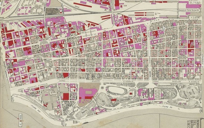
Il quartiere è il frutto dell'espansione della città a sud di corso Vittorio Emanuele II, nella seconda metà dell'Ottocento. E' compreso tra la ferrovia a ovest e il fiume Po a est e si sviluppa lungo le grandi direttrici nord-sud, corso Massimo d'Azeglio e le vie Madama Cristina e Nizza. Nato come quartiere residenziale, non ha mai compreso al suo interno insediamenti industriali.
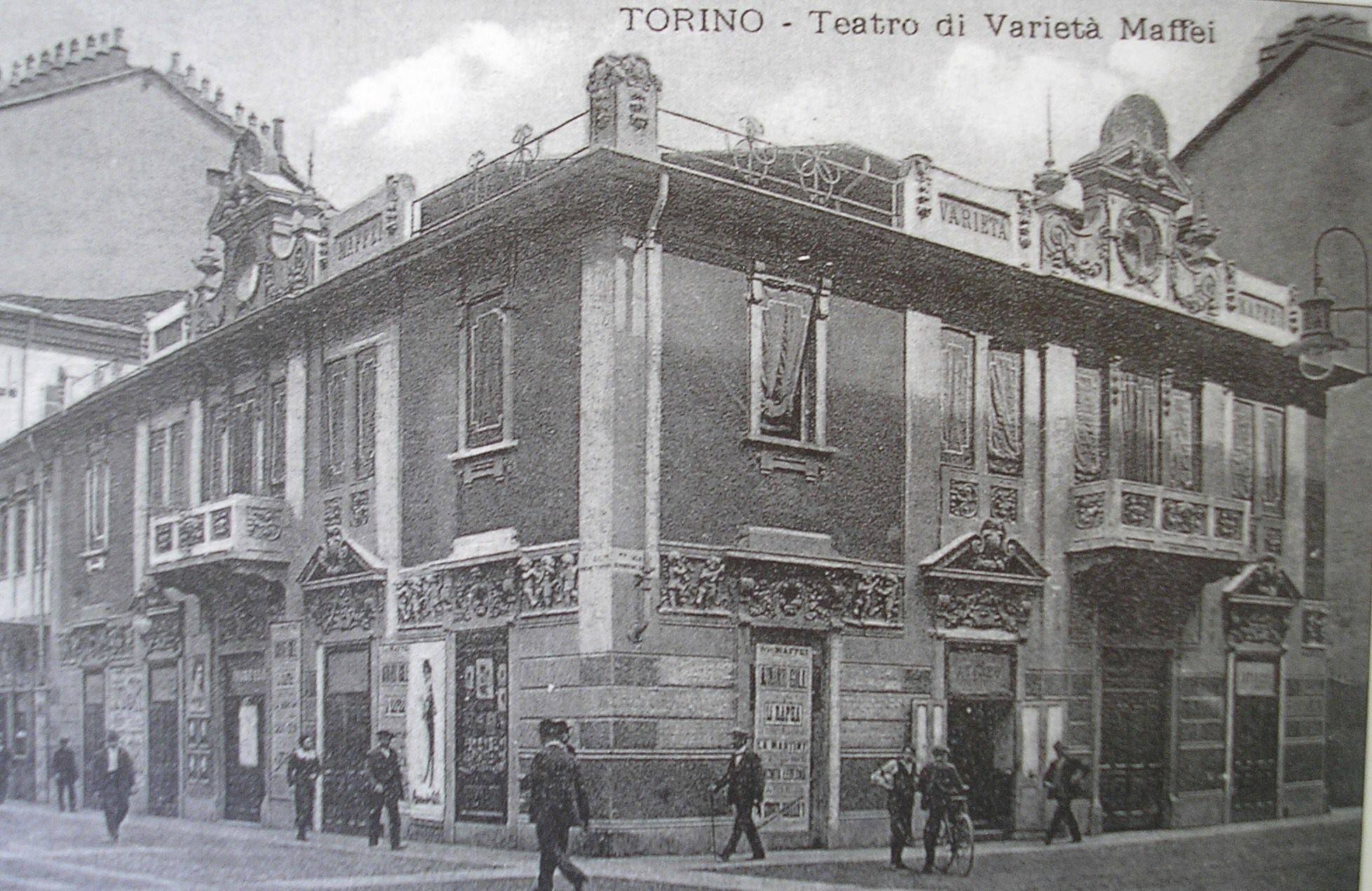
Luoghi / Cinecafè Teatro Maffei
Il Teatro Maffei rappresentava agli inizi del XX secolo uno dei primi locali torinesi, insieme al Cinema Ambrosio a ospitare, oltre che spettacoli di varietà, anche un caffè, sul modello dei cafè chantant parigini. La struttura venne ideata nel 1908 da Ernesto Maffei sull’area di un edificio precedente. Dal 1976, il luogo ha interrotto le proiezioni comuni per dedicarsi esclusivamente alla programmazione pornografica.
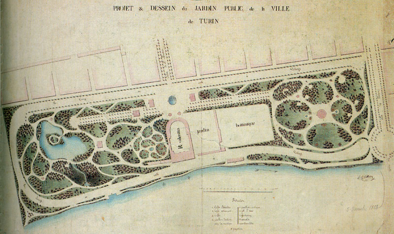
Luoghi / Il Parco del Valentino
P. B. Kettmann, Proposta per un concorso di parco pubblico sui terreni demaniali al Valentino, 1854.
Storia / L'ampliamento verso Sud
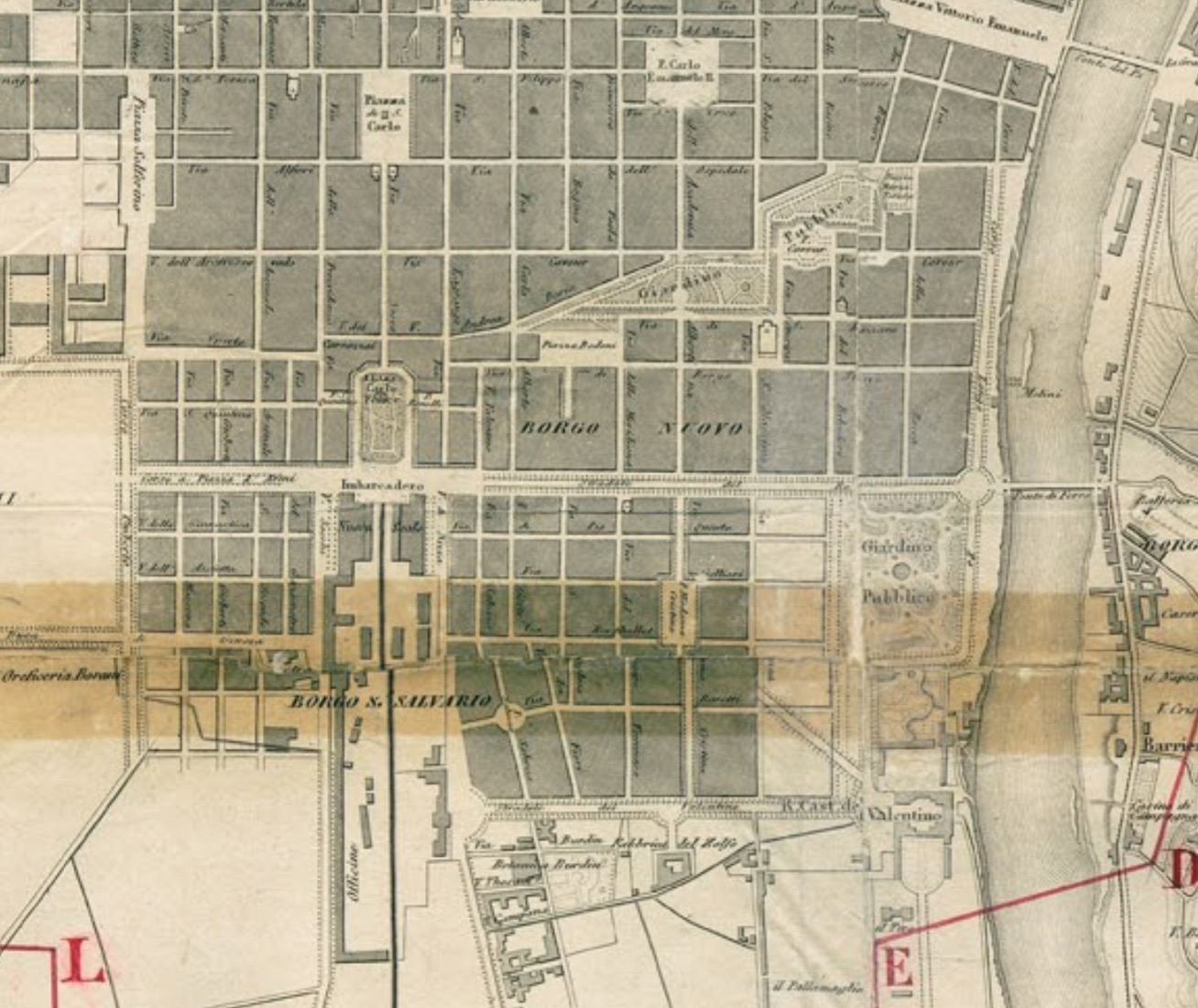
Lo sviluppo urbano del quartiere prende forma a seguito dell'approvazione del "Piano Regolatore pel Borgo San Salvatore" del 1846. L'espansione della città verso sud risulta l'unica praticabile, in quanto a nord si trovano gli impiati industriali e a ovest le servitù militari adiacenti la Cittadella. Le strade del nuovo ampliamento si attestano sulle medesime direttrici di quelle preesistenti a nord del viale del Re (corso Vittorio E.). L'arteria pricipale è Via Madama Cristina, in prosecu...
Storia / L'edificazione del quartiere
Con l'espansione edilizia degli anni Settanta, la zona viene dotata di una rete viaria regolare, che si riempie progressivamente di palazzi destinati soprattutto all'affitto. La maglia ortogonale si attesta sui grandi viali secondo le norme dettate dal Piano di ingrandimento del 1850 che delineava i principi sui quali si sarebbe sviluppata l'intera città per tutto il corso dell'Ottocento: integrazione strutturale con la preesistenza, proseguimento dei grandi assi della città antica, configur...
Storia / Il quartiere oggi
Ad oggi il quartiere ospita svariate attività del settore terziario. Dai primi anni del 2000, si è sviluppata una vivace vita notturna, caratterizzata da locali multietnici, pub e ristoranti. Il quartiere ospita anche due mercati rionali, uno in piazza Madama Cristina e l'altro in piazza Nizza. Inoltre il quotidiano torinese La Stampa ha le sue sedi in Via Lugaro.
Storia / All'inizio dell'Ottocento
La zona esterna a Porta Nuova , dopo l'abbattimento delle fortificazioni, dal Plan Geométrique di I.B. Sappa
Eventi / Le Esposizioni al Valentino
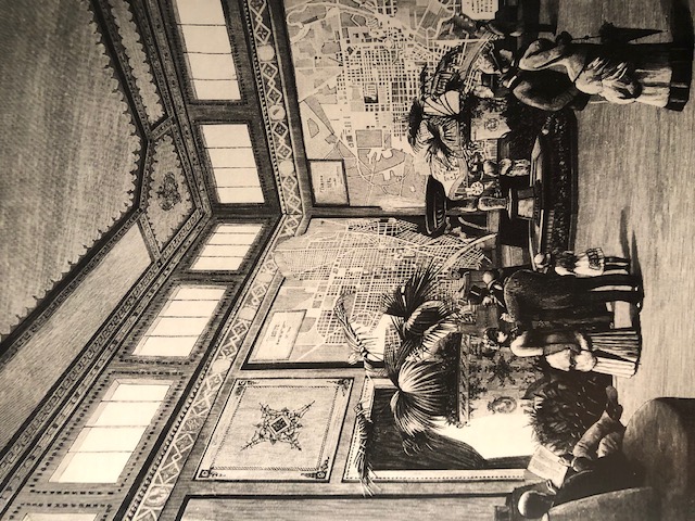
Il padiglione della città di Torino all'Esposizione generale del 1884
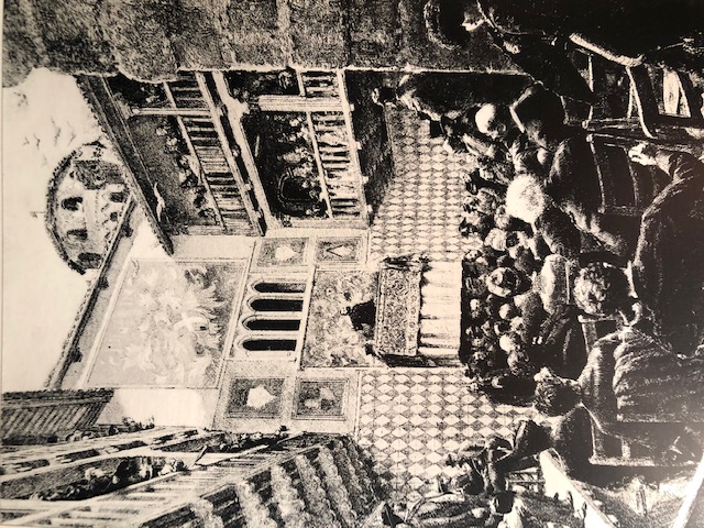
Nel 1884 la prima grande esposizione torinese lascia in eredità alla città il Borgo Medioevale, perfetta riproduzione di un castello del '400 e del suo borgo, edificata in meno di due anni, sotto la direzione dell'architetto D 'Andrade. Oltre al borgo vengono costruiti sulle rive del Po diversi edifici, progettati da Camillo Riccio, che occupano una superficie superiore a quella dell'esposizione internazionale di Parigi del 1867! Vengono presentate le opere dei principali archietti torinesi, ...
Una conferenza archeologica nel cortile del Castello medievale all'Esposizione del 1884
Particolari / Nel quartiere edifici religiosi di diversi culti
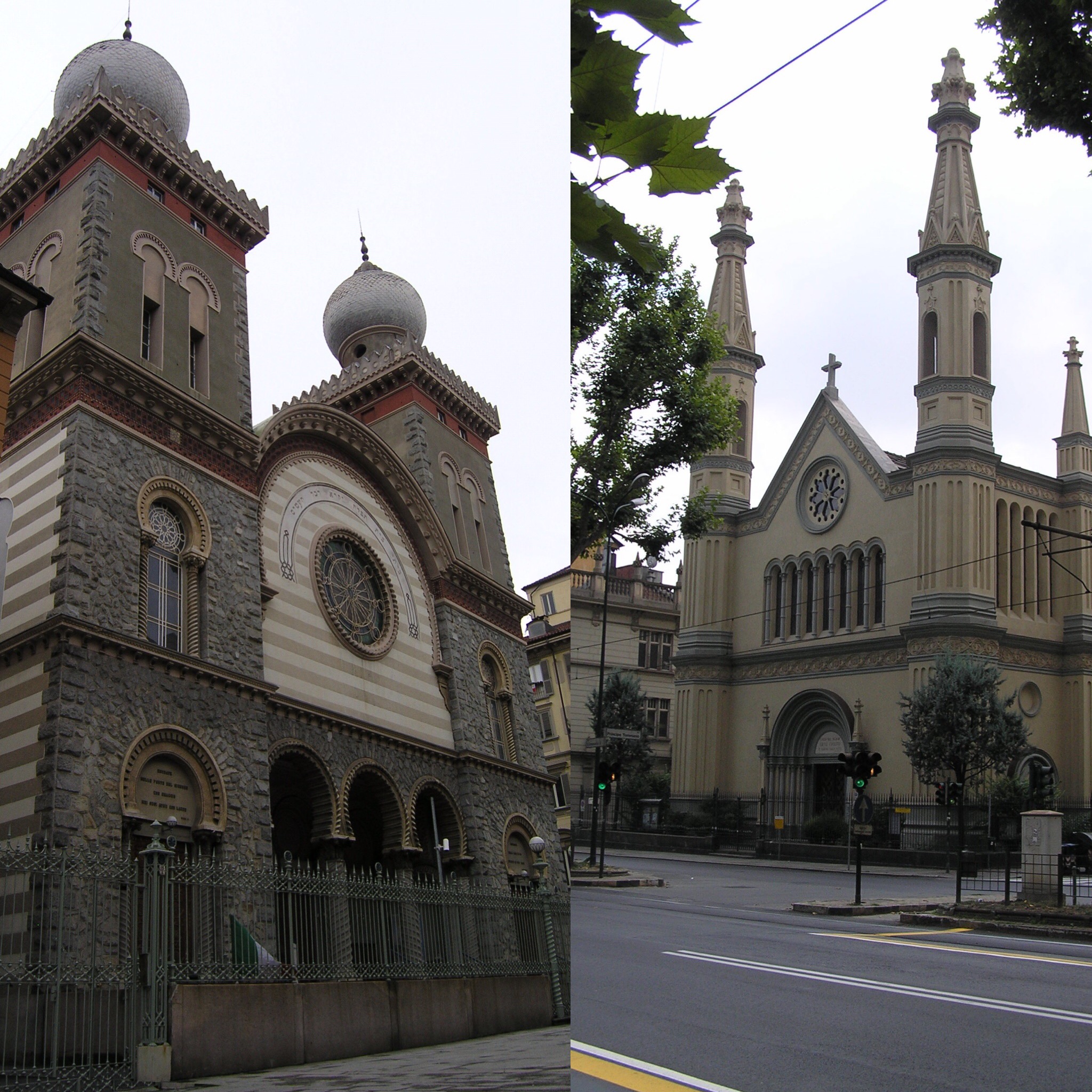
Il quartiere ospita sia la chiesa valdese risalente al 1853 che la sinagoga ebraica del 1884, due edifici religiosi, simbolo della libertà di culto concessa da Carlo Alberto nel '48 e della tolleranza della città verso le religioni non cattoliche. Entrambi gli edifici sono esempi dell'architettura eclettica tipica della seconda metà dell'Ottocento
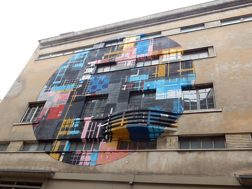
Particolari / Street Art a San Salvario
A partire dal 2015 tramite "Street Artist" italiani ed internazionali, è stato creato un percorso molto originale tra le vie del quartiere, tramite disegni realizzati su diversi edifici.
Racconti / Una stella sola
Estratto in cui è visibile l'ex teatro Maffei. Come una sorella (Itala Film, 1912) Regia: Vincenzo C. Dénizot
Approfondimenti
- Borgo San Salvario in Wikipedia —l'enciclopedia libera
- Borgo San Salvario in Wikimedia Commons —l'archivio multimediale libero

